Information on the effects of human-induced disturbances on sediment yields and sediment sources from catchments is limited. Such information could be used to guide decisions on the application of catchment rehabilitation measures.
A study by NIWA was designed to analyse the sediment yields and dynamics of suspended sediment event for a 12 year period from two paired headwater catchments within the Whatawhata Research Station in the Waikato Region. One catchment (Whakakai) was entirely vegetated in indigenous forest, while the other (Mangaotama) was of mixed land use. Near the beginning of the study period an integrated catchment management (ICM) plan was implemented within the Mangaotama catchment. This plan included riparian planting, exclusion of cattle from riparian areas, planting of degraded land in Pinus radiata and changes in stock management.
Stream flow and turbidity were recorded continuously at both catchments between 1999 and 2010. The turbidity data were calibrated with measurements of suspended sediment concentration (SSC) and used to determine event and annual sediment yields. Event sediment yields within the Mangaotama catchment were similar to Whakakai catchment during small events. For larger, less frequent events the event yields from Mangaotama exceeded Whakakai by a factor of about three, probably due to the initiation of mass movement on steep pasture hillslopes. On an annual basis, the mixed land use Mangaotama catchment generated around 60 per cent more sediment than the indigenous forest Whakakai catchment.
Obtaining continuous records of both flow and turbidity/SSC also allowed us to infer catchment sediment sources by analysing the relationship between SSC and discharge. Within the Mangaotama catchment, we inferred that near-channel (e.g., stream bank erosion) sources dominate. Near-channel sources appear to dominate throughout the study period despite major changes in land use. This may be due to a switching of erosive mechanisms. During the pre-ICM period, mechanical erosion by unrestricted cattle access to streams resulted in banks being important sources of sediment. During the post-ICM period, shading of banks by riparian vegetation inhibited the growth of protective groundcover vegetation and therefore increased the importance of preparatory erosion processes (e.g., desiccation, rainsplash and micro-rill development of bare banks). Within the Whakakai catchment, the SSC-discharge relationship was more complex, but results indicate that hill-slope sources are likely to be the principal source of eroded sediment.
The study provides valuable insight that can be used to guide the development of integrated catchment management plans and decision making on rehabilitation measures.
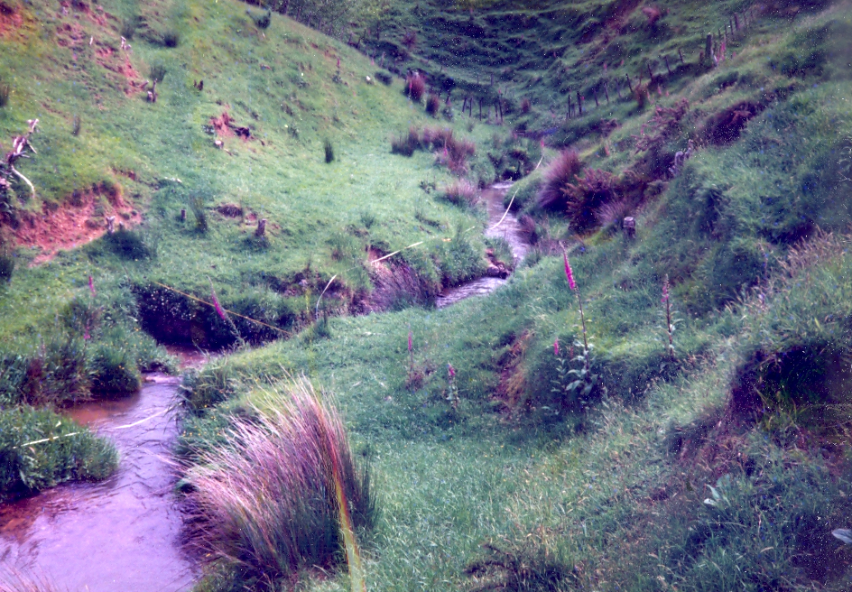
A typical Whatawhata stream channel before the implementation of the integrated catchment management plan, pre-2001. Photo by John Quinn.