
-
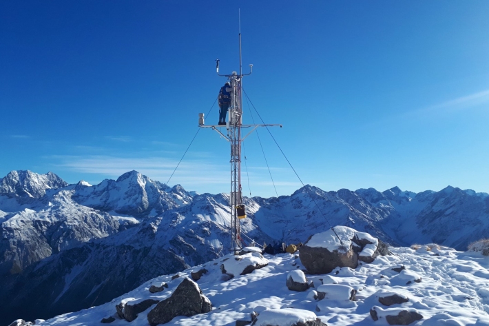
Upper Rakaia electronic weather station (EWS)
The Upper Rakaia SIN site is located at 1752 m on a north facing slope in the Jollie Range. Records start in 2010. -
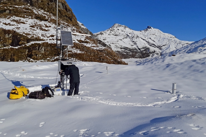
Albert Burn electronic weather station (EWS)
The Albert Burn SIN site is located at 1280 m in the upper Albert Burn valley, east of Mt Aspiring/Tititea. Records start in 2012. -
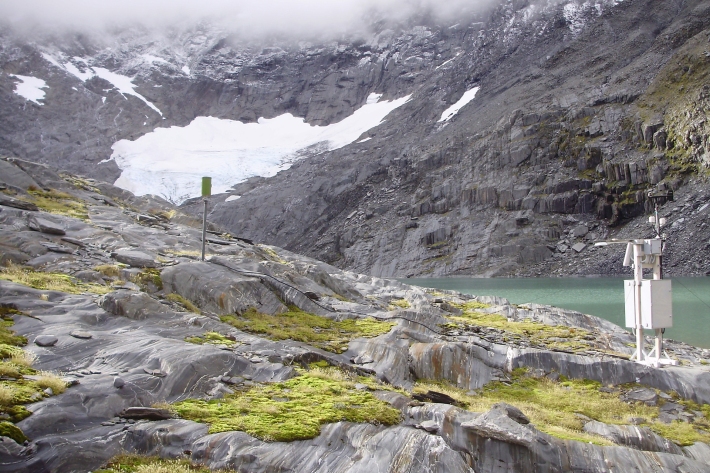
Ivory Glacier - compact weather station (CWS)
The Ivory Glacier SIN site is located at 1390 m next to Ivory Lake, west of the main divide of the Southern Alps/ Kā Tiritiri Te Moana. -
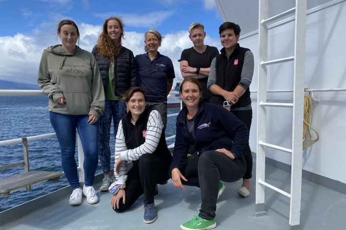
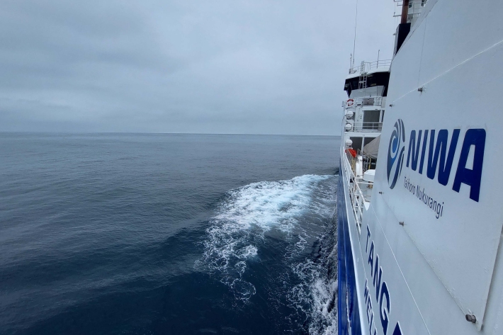
2022 - Tasman Sea tsunami
VoyageYou’ll be blown away by what these women in science are doing onboard RV Tangaroa in the Tasman sea! -
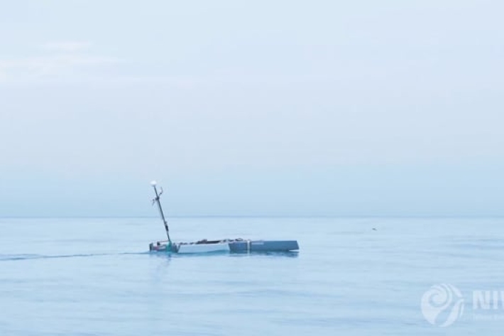
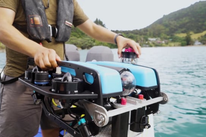
A robot sea craft helps count fish
A six-metre-long autonomous vessel is equipped with artificial intelligence and a range of data gathering equipment, including a battery powered echosounder that can estimate the size of fish populations. -
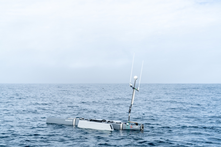
Cutting-edge AI sea craft helping scientists count fish
Media release21 February 2022A robot sea craft is the latest tool NIWA scientists are using to help them count fish. -
Mapping the oceans through citizen science
The Seabed 2030 South and West Pacific Ocean Data Center is one of four global Regional Centres, each being responsible for data gathering and mapping in their territory. -
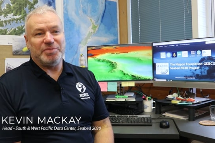
Seabed 2030
Did you know NIWA is leading a NZ partnership in a worldwide initiative to map the entire globe’s seafloor? Found out more about the Seabed 2030 initiative. -
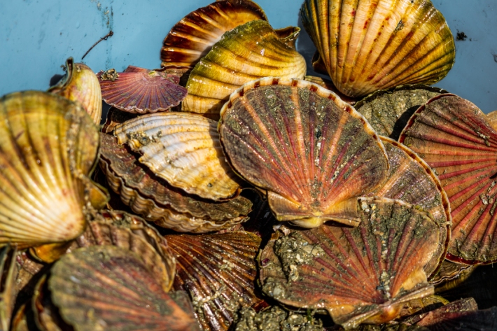
Surveying scallop populations with artificial intelligence
News article21 December 2021Scallops are a shellfish delicacy precious to many New Zealanders. They are an important kaimoana species for tangata whenua and have long been a sought-after species for commercial and recreational fishers. -
2021 - Macquarie Ridge
VoyageRV Tangaroa has sailed to the Macquarie Ridge to under charter by Australia’s CSIRO Marine National Facility to recover ocean bottom seismometers and acquire multibeam sonar and sub‐bottom profile data in the Macquarie Island region. -

Stewart Island gets new electronic weather station
Media release24 August 2021A closer eye is now being kept on Stewart Island’s climate thanks to the installation of a new electronic weather station. -
Surveying scallops populations with artificial intelligence