-
Tropical seafloor secrets revealed
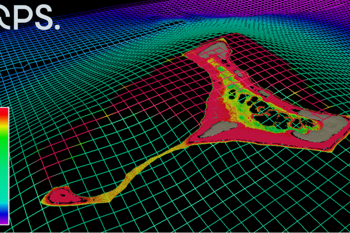
Media release25 February 2022NIWA scientists and Toitū Te Whenua Land Information New Zealand (LINZ) have used satellite technology to chart the Cook Islands’ seafloor in never-before-seen detail. The work was done as part of Seabed 2030 - a collaborative project to produce a definitive map of the world ocean floor by 2030. -
Mapping the oceans through citizen science
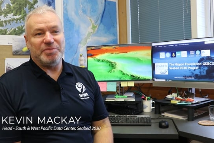
The Seabed 2030 South and West Pacific Ocean Data Center is one of four global Regional Centres, each being responsible for data gathering and mapping in their territory. -
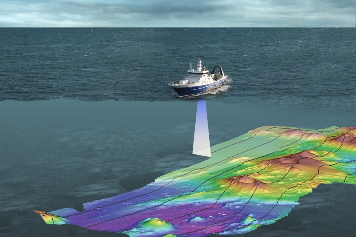
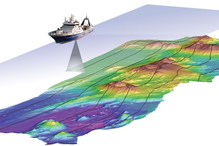
Seabed 2030
Did you know NIWA is leading a NZ partnership in a worldwide initiative to map the entire globe’s seafloor? Found out more about the Seabed 2030 initiative. -

Norse goddess reveals seabed secrets
Feature story11 February 2021A large, orange Scandinavian robot gives NIWA’s marine geologists an in-depth look at changes to the seafloor off Kaikōura. -

2020 - Separation Point nursery
VoyageNIWA researchers are heading out from Tasman early next week to survey an area thought to be home to important juvenile fish nurseries. -
Researchers on hunt for fish nurseries
Media release07 August 2020NIWA researchers are heading out from Tasman early next week to survey an area thought to be home to important juvenile fish nurseries. -
NIWA mapping seafloor around Whakaari/White Island
Media release16 July 2020NIWA scientists are heading to the waters around Whakaari/White Island in the Bay of Plenty next week to survey changes to the seafloor. -
2020 - Campbell Plateau biodiversity
A team of scientists and crew headed to the Campbell Plateau south of New Zealand onboard R.V. Tangaroa to conduct a deep-sea camera survey of the seabed to better understand the biodiversity of seabed habitats in commercial fishing areas. -
Scientist pieces together details of underwater landslides
Media release28 November 2019New information about landslides that occur on the seafloor off New Zealand’s east coast will help scientists better understand why and where they happen, and the types of threats they pose. -
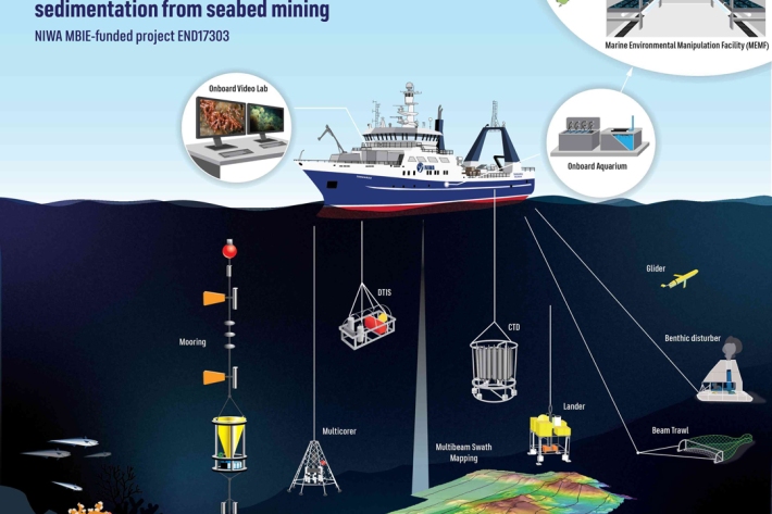
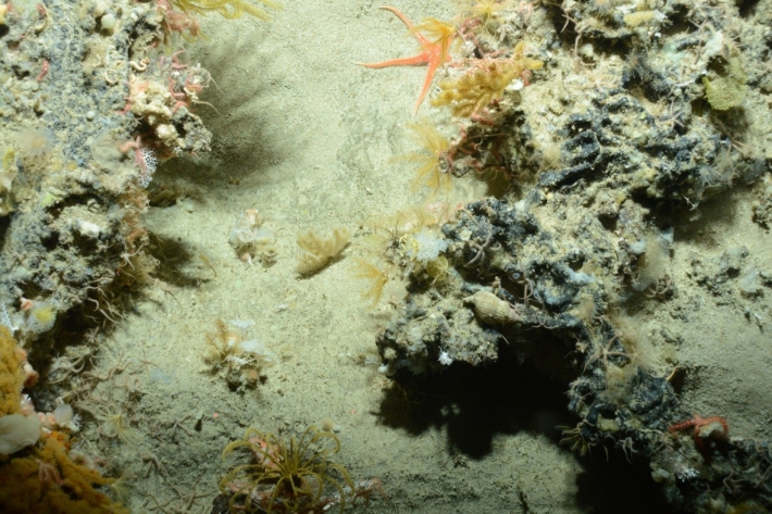
Sedimentation effects
Research ProjectA combination of field surveys and on-site observations are being used along with laboratory-based experiments to determine the effects of seabed disturbance on benthic life. -
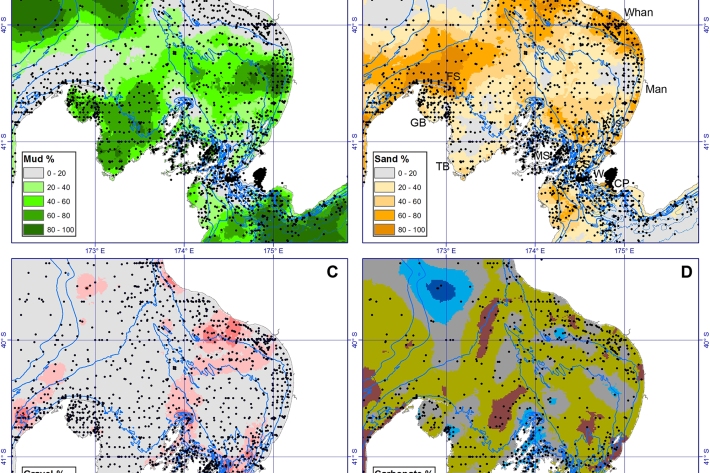
Handwritten files provide sediment treasure chest
Media release02 October 2018A NIWA scientist who spent years poring over handwritten scientific notes stored in about 50 large wooden drawers, has seen the fruits of her labour now being used in ways she never imagined. -
Scientists set to delve into the secrets of the Cook Strait mega-canyon
News article06 June 2017