-
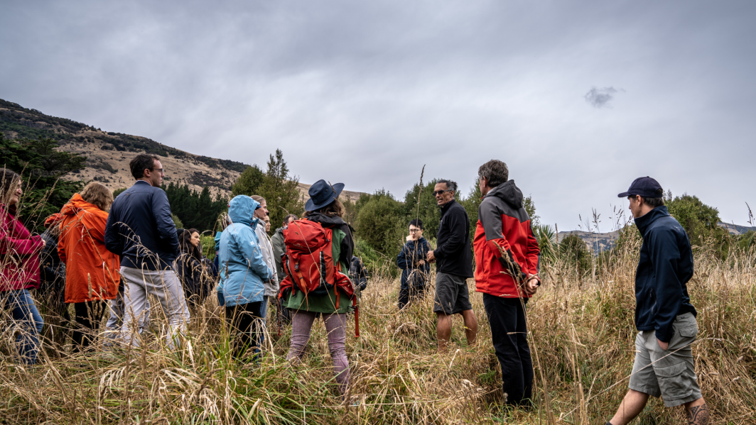
A say on the sea shore
Feature story16 October 2018Coastal communities around New Zealand are getting a say on how to respond to sea-level rise, and NIWA is helping them. -
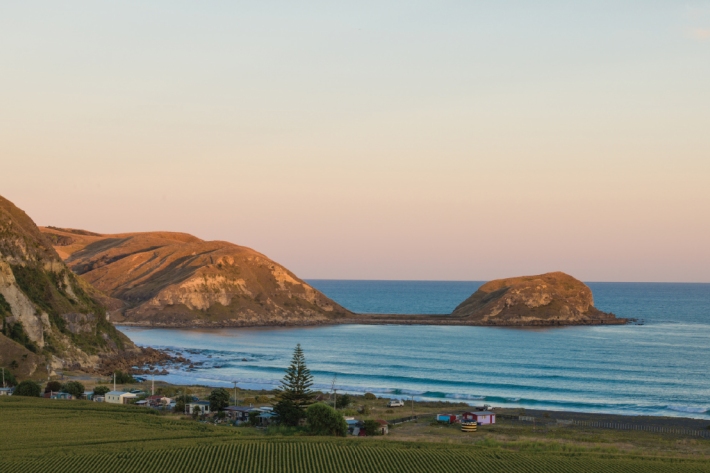
Te Huringa ki te Rangi – He Rautaki Tāwariwari. Adapting to climate change – a decision-making model for Indigenous Peoples
Te Huringa ki te Rangi is a decision-making model to support indigenous and coastal communities who are grappling to understand and evaluate climate change impacts and risks, and how to integrate these into their development plans for the future. -

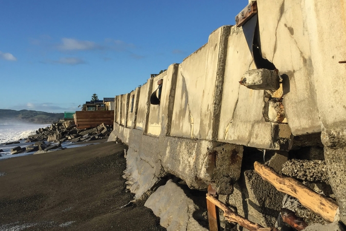
Councils get help to prepare for sea-level rise
Media release18 July 2018A senior NIWA scientist is concerned many councils are having difficulty “getting off the starting blocks” when it comes to planning for coastal climate change. -
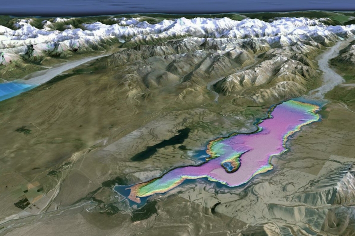
Lake Tekapo study raises awareness of tsunamis in NZ lakes
Media release12 June 2018A pilot project has provided the most advanced mapping of a New Zealand lake ever and highlights the hazard to lakeside towns of tsunamis caused by landslides. -

NIWA urges farmers to prepare for climate change
Media release06 June 2018NIWA is encouraging farmers to plan for climate change so they can maximise their abilities to adapt and thrive as significant change begins to take place. -
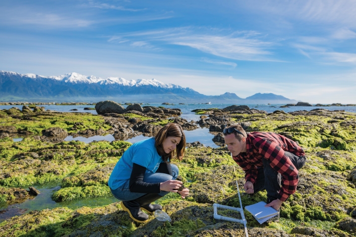
Drones watch quake aftermath
Feature story19 April 2018NIWA scientists like Leigh Tait were saddened by the human impact of the 2016 Kaikoura earthquake, but he also says that it provided a “massive natural history experiment”. -

Beating drought
Feature story10 April 2018How a regional climate history helped save a farm and cure depression -
2018 - OBS Recovery
VoyageThe RV Tangaroa is assisting in New Zealand’s largest ever deployment of seafloor earthquake recording instruments in a bid to learn more about the earthquake behaviour of the tectonic plates beneath the east coast of the North Island. -
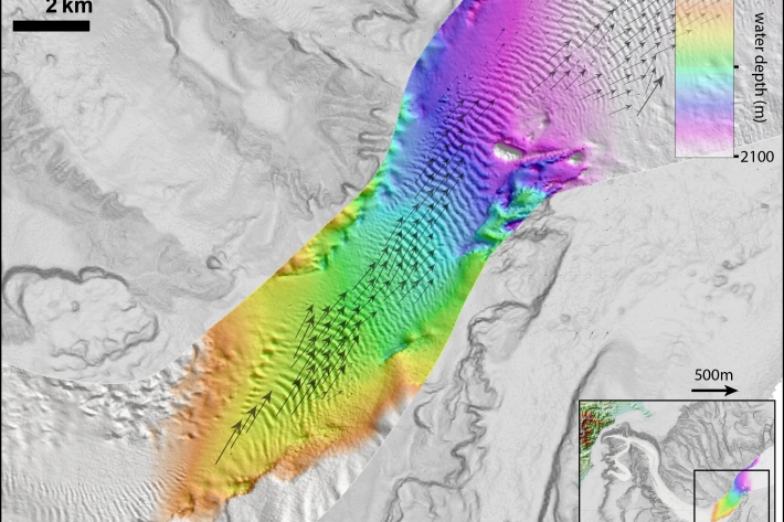
Kaikōura earthquake generated huge submarine sediment shift
Media release15 March 2018The 2016 Kaikōura Earthquake has shown that more than 100 million dumptrucks of mud and sand flow through the Kaikōura Canyon every 140 years, scientists say. -

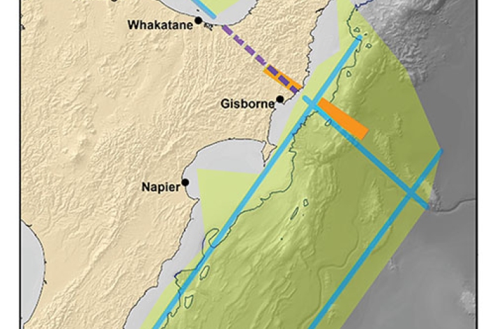
2017 - Hikurangi subduction zone
The Tangaroa assisted in New Zealand’s largest ever deployment of seafloor earthquake recording instruments in a bid to learn more about the earthquake behaviour of the tectonic plates beneath the east coast of the North Island. -

NIWA co-leads international expedition to study New Zealand’s largest earthquake fault
Media release21 November 2017An ambitious scientific expedition involving 30 scientists from around the world leaves Perth next week bound for the East Coast of the North Island.
