PDF of this article (244 KB)


NRWQN turns 20
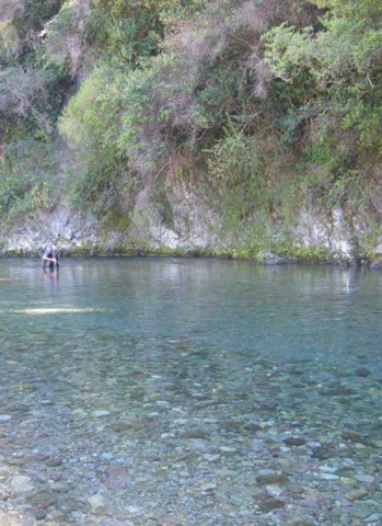
New Zealand’s National Rivers Water Quality Network is celebrating two decades of effort collecting and analysing more than 18 000 samples of river water from around New Zealand. The Network was set up to detect trends and condition in water quality and to provide advice to government on the management of water resources. New Zealand has about 425 000 kilometres of rivers and streams, which are highly valued for recreational activities such as swimming and boating, and provide essential services such as drinking water supply, irrigation, and hydroelectricity.
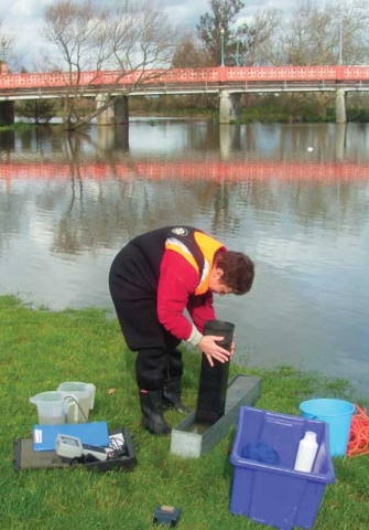
Every month since January 1989, NIWA’s Environmental Data (ED) staff have visited 77 sites on 35 of New Zealand’s larger rivers to take measurements and collect samples for assessing water quality. This complements monitoring on (mostly smaller) waterways carried out by regional authorities. The NRWQN sites were carefully selected to provide a national perspective of the condition of the country’s rivers and trends in water quality.
While on site, NIWA staff measure the dissolved oxygen concentration in the water, its temperature, and visual clarity. They also assess the algae growing on the river bed (known as periphyton). They collect a water sample for laboratory analysis of pH, salt content, water cloudiness, coloured dissolved organic matter, nitrogen, and phosphorus. A separate sample is tested for E. coli (a bacterium that is usually harmless, but indicates faecal contamination).
The NRWQN dataset now contains more than a quarter of a million data points. These data show that, by international standards, New Zealand’s rivers are in good condition overall, especially rivers in native forest and high country areas. On the other hand, rivers running through pastoral areas suffer from nutrient enrichment, cloudiness from suspended fine sediment, and contamination by faecal microbes. The microbial pollution is of particular concern because it makes rivers unsuitable for swimming.
Trend analysis of 20 years of monitoring data shows that pollution of New Zealand rivers from point sources (such as discharges of wastewater from towns and industries) has reduced appreciably since the late 1980s. Over the same time, however, nitrogen and phosphorus levels have increased at many sites, due largely to ‘diffuse pollution’ from pastoral farming. This is the result of increased stocking rates and use of fertilisers, and conversion of land used for plantation forestry or sheep/beef farming to dairy or deer farms.
Rob Davies-Colley, who uses the data in his studies of aquatic pollution, says the NRWQN has been crucial for calibrating models for exploring how future land uses and climate might affect water quality. “We’re pleased the NRWQN has been useful for a wide range of other scientific research. For example, we've used the Network to measure carbon travelling down New Zealand rivers - and found that this flow of carbon to the sea, coming ultimately from soils, is the equivalent of about 40% of New Zealand's fossil fuel carbon emissions. We've also recently combined river quality data with satellite images of coastal areas to track river plumes. These can affect coastal water quality and could impact on marine reefs and shellfish aquaculture."
Data collected over the last 20 years has also provided important imformation that is helping government agencies manage and protect New Zealand rivers.
Mike Thompson, senior adviser at the Ministry for the Environment (MfE), describes the NRWQN as one of the cornerstones of the Ministry’s Freshwater State of Environment (SoE) reporting programme.
“The coverage, continuity and consistency of the NRWQN monitoring is unique in New Zealand, and invaluable for national reporting purposes. It allows us to determine with confidence the quality of water in our larger rivers, and how they are changing over time.
“While the monitoring of these rivers does not tell us everything about the health of our waterways, it gives us the best collective indication of the pollution impacts of land use on river water quality at a national scale. This information is crucial to help understand how widespread pollution problems are and what management actions are needed.”
The monitoring has also increased scientific knowledge of New Zealand river ecosystems and assisted in environmental work, here and overseas. Annual reports are produced each year and NRWQN data are available (free) to subscribers online. Seven of the scientists who have been involved with the network since its inception are preparing a review article emphasising NRWQN operations and its diverse science and consulting applications over 20 years.
The NRWQN is mainly funded by the Foundation for Research, Science and Technology.
For further information contact: Dr Rob Davies-Colley, 0-7-856 1725, [email protected] Dr Clive Howard-Williams, 0-3-343 7857, [email protected]
