New Zealand is a land of erosion.
We’re losing about 192 million tonnes of soil a year, according to the latest report Our Land 2018, from the Ministry for the Environment and Statistics NZ. It says New Zealand is contributing about 1.7% percent of the sediment delivered to the world’s oceans annually due to soil erosion, even though the country accounts for just 0.2% of global land area.
A lot of this lost soil comes from natural erosion. However, over 40% of the soil entering our rivers comes from pasture.
According to Dr Andrew Swales, an estuarine physical processes scientist who leads NIWA’s Catchments to Estuaries programme, New Zealand is particularly susceptible to erosion due to the country’s steep lands. They have more erosion potential due to their slope, their geology, high intensity rainfall and earthquakes.
It’s a potent mix: many places have highly erodible sedimentary rocks, earthquakes destabilise hillslopes, and rain triggers slope failure and landslides.
While soil erosion and sedimentation are entirely natural processes, the rates increased markedly due to loss of forest landcover with the arrival of people in New Zealand, says Dr Swales. Deforestation and present-day land-use practices have increased New Zealand’s existing susceptibility to erosion.
"We're losing about 192 million tonnes of soil a year ... about 1.7 percent of the sediment delivered to the world's oceans annually"
Prior to human arrival, sedimentation rates in our estuaries were typically much less than 1mm per year on average. As catchments were deforested, the average sedimentation rates increased 10-fold.
“Typical rates in upper North Island estuaries over the last century are in the order of 2–5mm per annum,” says Dr Swales.
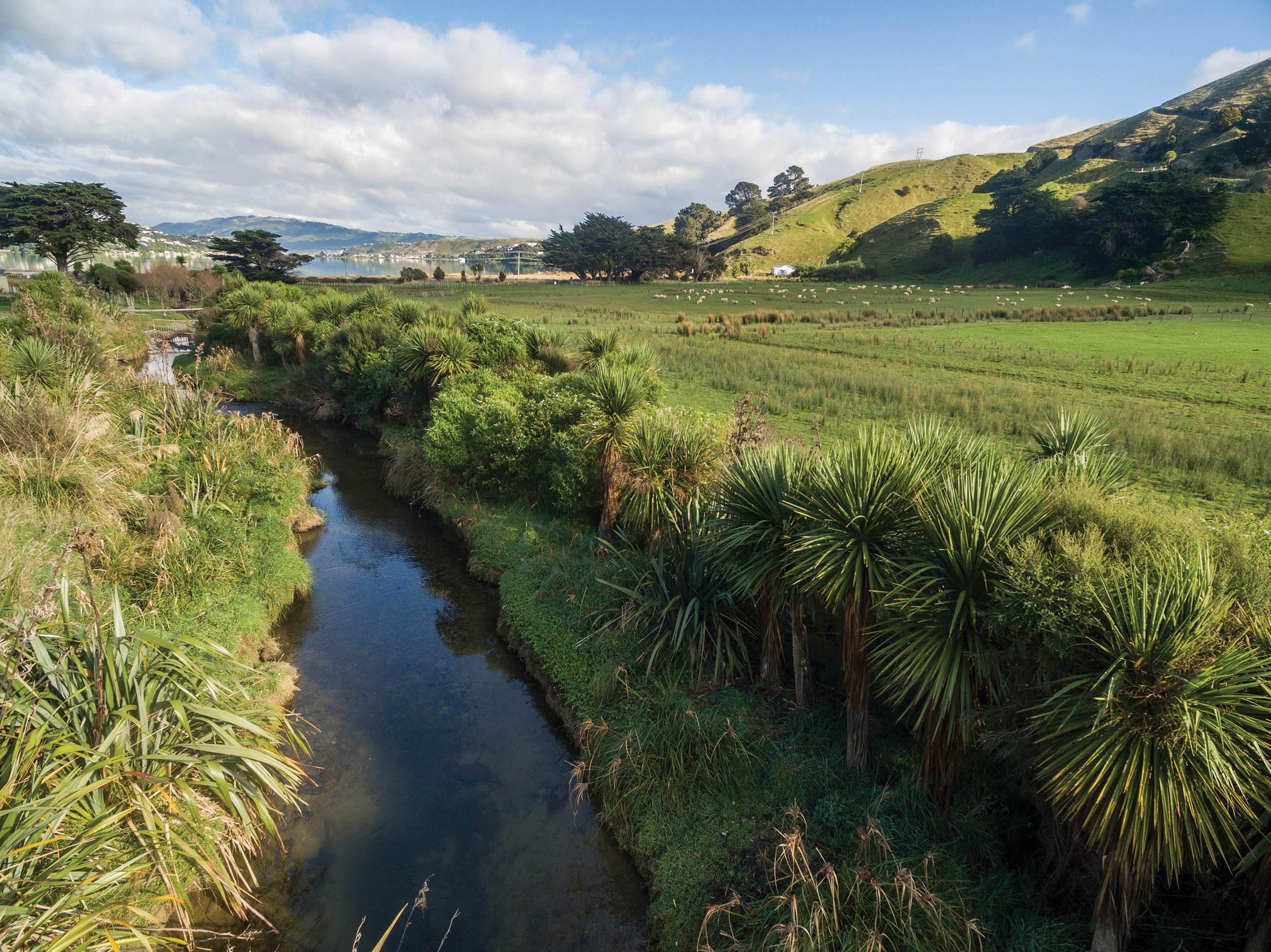
The result of this accelerated sedimentation has been the formation of intertidal mudflats in place of the sandflats that characterised many estuaries prior to catchment deforestation.
In upper North Island estuaries, these rapidly accreting mudflats have been colonised by mangroves, where shellfish previously lived.
“It’s a double whammy,” he says. “We’re losing productive soils from the land, and these eroded soils are having adverse effects in estuaries.”
Known as the “universal contaminant”, some of the most damaging effects of fine sediments accumulating in our estuaries are related to clays that are less than 4 microns in diameter.
“They’re the most effective at decreasing sunlight … they reduce the visual clarity of the water. Many predatory species, including fish and birds, are visual predators, using their eyes to find their prey,” says Dr Swales.
Fine sediments carry other contaminants with them, including heavy metals, organic contamination from stormwater runoff, and microbes which are harmful to human health.
“A fraction of that contamination is conveyed by fine sediments and deposited in estuaries,” says Swales. “In rural settings the fine sediments carry phosphorus with them as well.”
Erosion can be reduced by changing the type or scale of land use or adopting practices to mitigate losses. But before we can do that, we need to work out which land use is responsible for the sediment.
Tracing sediment
Dr Swales says one way to trace the sources of fine sediments is by using stable isotopes. These are non-radioactive forms of atoms found in almost all of the first 80 elements in the periodic table. They have been used as a kind of natural ecological recorder, to trace things like sources of water, sources of various foods, and even tracking counterfeit money.
Dr Swales's colleague, emeritus scientist Dr Max Gibbs, was the first person to identify that compound-specific stable isotopes (CSSI) and their isotopic signatures could be applied to tracing the sources of fine sediments. He published his work on the CSSI sediment tracing method in 2008.
All organic life has fatty acids. All plants secrete their fatty acids into the surrounding soil. The fatty acids of plants like native trees, forestry pine, grass and food crops typically have different ratios of the two main isotopes of carbon, 12C and the slightly heavier 13C.
These isotopic signatures can still be found in sediment, which means you can label sediment by the land use from which it originated.
“When you collect sediment from an estuary, lake or river, it’s going to come from a mixture of various sources,” says Dr Swales. “We analyse samples for their stable isotopic signature, and use a model to unmix that mixture. That allows us to apportion the average contribution of different plant communities, which gives an outline of the contribution of different land uses.”
Stable isotopes provide information on the sources of sedimentation. When combined with measurements from radioisotopes, the rate of sedimentation can be determined.
The CSSI method can analyse a dated sediment core taken from an estuary or a lake and provide information about how sources have changed over time.
Other studies
NIWA is participating in a study with the International Atomic Energy Agency (IAEA) and the Food and Agricultural Organization (FAO).
NIWA is bringing together the CSSI and radioisotope methods to capture persistence information from sediment cores as well as determining how land-use change influences the isotopic signatures of soils. NIWA’s contribution to this international study includes a case study that has measured rates of change in soil isotopic signatures associated with a pine-to-dairy land-use change near Taupo that has occurred since the 1980s.
In New Zealand, the Ministry for the Environment has been commissioning research into sediments, primarily the effects of sediments in rivers. Dr Swales says it is likely that in the future there will be more focus on estuaries, as well as setting limits for different contaminants, including fine sediments.
Separately, NIWA’s Managing Mud programme is providing new knowledge and tools to underpin better management of fine sediments and their effects.
More sediment likely
Dr Swales warns that climate change will have a further impact on sedimentation. It is likely that New Zealand will be subject to more of the high intensity and frequent rainfall events that have massive erosion potential.
“There might be a need to modify the pattern of our land use. Potentially, that’s both in space and timing of what we grow, and where we do things to mitigate the effects,” he says.
The solution is not necessarily as obvious or easy as planting trees. Dr Swales notes that landslides from high intensity rainfall events can even occur in regenerating native forests.
“It’s taken us 150 years to get to this point. Trying to change the trajectory we’re on, or mitigate the effect, is going to take some time and quite a lot of effort.”
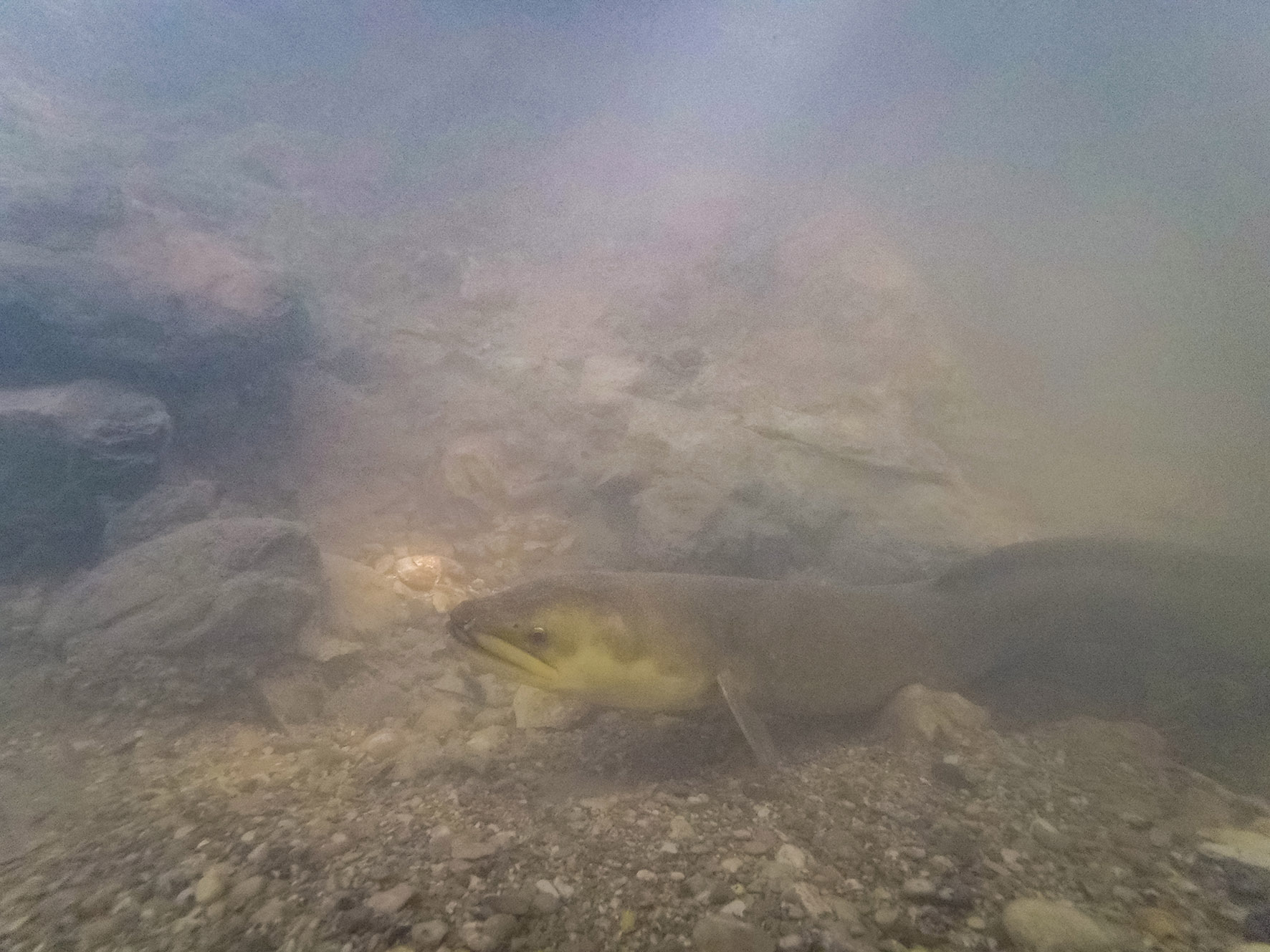
How much can fish handle?
Based on seven years of research, NIWA has established turbidity limits to protect fish in New Zealand rivers.
Turbidity is the measure of cloudiness in water. It is caused by tiny particles in the water, including fine sediments.
The application of turbidity limits to protect fish depends on knowledge of both the distributions and life history patterns of sensitive species. To help water managers apply turbidity limits, NIWA has developed a decision support system (DSS).
The DSS has two parts: one for peak-flow (that is, floods) and one for base-flow. In floods and other peak-flow conditions, extreme turbidity may kill fish. Whereas in base-flow conditions, long-term exposure to sublethal toxicities can reduce populations and affect fish behaviour.
The DSS can be used for planning purposes, monitoring, and restoration, but only covers direct effects of increased turbidity on common riverine fish. It does not address the potentially more insidious, indirect effects of settled solids on river or steam habitats. Current NIWA-led work for the Ministry for the Environment is addressing both direct and indirect effects.
Are trees the answer?
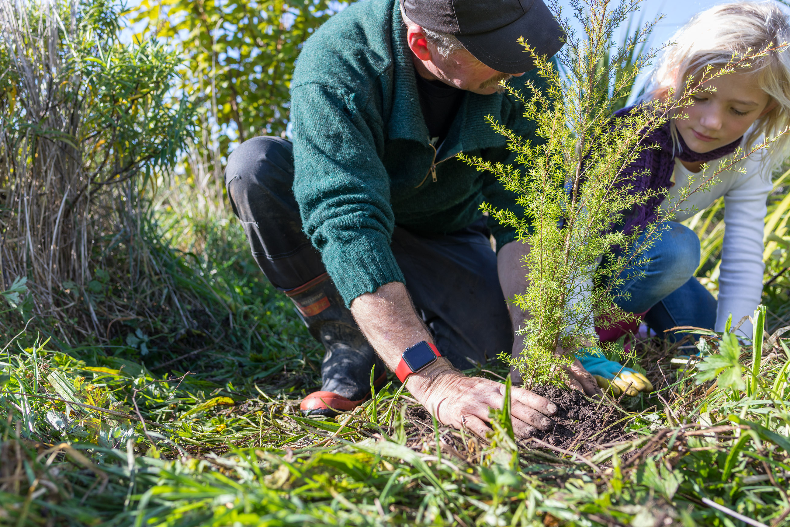
Planting trees is one solution to the problem of sedimentation.
Trees change several processes in a catchment, according to NIWA hydrologist Dr Christian Zammit.
Firstly, the soil is anchored both by the tree roots and organic matter generated under the tree. “Tree roots grab the soil, which avoids soil being moved further downstream”, says Dr Zammit, who is the Programme Leader – Water Resources at NIWA.
Trees can also slow water running off land surfaces during high rainfall events. “This will impact the velocity at which the soil is moved,” he says.
Trees also intercept much more precipitation than grass. “This means there is less water received by the soil. Less water means a bigger proportion infiltrates through the soil instead of creating direct runoff.”
In addition, trees provide a path for water to go directly to the root system, and deeper into the soil. “Basically, reducing the amount of surface flooding that could generate sediment runoff,” says Dr Zammit.
He cautions that all that water-redirection and retention can have consequences when using trees for erosion control, as it typically reduces the amount of water available for uses such as water catchment.
Acknowledging that trees have many benefits (including an impact on soil erosion), the Government has committed to planting one billion trees over the next ten years.
“Planting trees reduces erosion by helping to keep the soil on the land and improving pasture productivity and water quality,” Julie Collins, Head of Forestry, Ministry for Primary Industries told Stuff in April.
The programme “will see us go from [planting] 55 million trees this year, to 70 million a year in 2020, to 90 million in 2021. From there we will be aiming for 110 million a year over the next seven years,” said Forestry Minister Shane Jones in a media release in February.
A billion trees over ten years doubles the current number of trees being planted in New Zealand. At the moment, there are 50 million trees planted each year, or 500 million over ten years.
At present it is unclear exactly how the one billion tree programme will work. “I suspect sometime next financial year, one of the funded projects will start looking at what needs to be done, what type of trees need to be planted, where, and at which density,” says Dr Zammit.
Ms Collins echoes this. “An important focus is about planting the right tree, in the right place, for the right purpose.”
According to Minister Jones, planting will include exotics and natives and will focus on commercial crops as well as environmental and regional gains. “We want to enable planting of a mix of permanent and harvestable forestry, using both exotic and native tree species on private, public and Māori-owned land. Species include radiata pine, redwood, tōtara, eucalyptus, Douglas fir and mānuka,” he said in a statement.
Dr Zammit believes the programme is a “great opportunity to redesign the New Zealand landscape to be sustainable under climate change.”
To mitigate sedimentation, forest planting is usually conducted at the top of a catchment where precipitation falls the most. However, one of the ideas that could be explored would be to “redesign land management at a catchment scale by planting some forest further downstream at a lower density,” he says. Planting along waterways lower in the catchment would reduce the amount of soil lost to streams, but at the same time provide an ecological corridor and refuge under climate change. It would also “provide shading for the stream, so maintaining fish populations at a longer time span,” says Dr Zammit.
The Government is currently considering a proposed research strategy for the one billion tree programme, including whether a model should be established to indicate the best position and density for the trees. Minister Jones has said that he expects to make more announcements about where trees will be planted in coming months.