-

Extreme weather - winds and tornadoes
Education ResourceDue to its position in the 'Roaring Forties', a belt of strong winds in the Southern Hemisphere which generally occur between the latitudes of 40 and 49 degrees, as well as its small size, New Zealand is a windy country. -
Kiribati plans for climate change
-
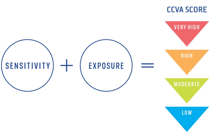
Climate Change Vulnerability Assessment (CCVA)
ServiceTo prepare for changes in climate, our freshwater and oceans decision-makers need information on species vulnerability to climate change. -
Risk and vulnerability
Education ResourceRisks from natural hazards are part of every day life for New Zealanders. -
Sea levels
ServiceThis system combines daily sea-level data from NIWA, regional councils, port companies, Antarctica NZ, Bureau of Meteorology and territorial authorities. -
Waves
Education ResourceThe waters around New Zealand have some of the highest waves in the world, due to Southern Ocean swell and storms in the Tasman Sea and Pacific Ocean. -
Cam-Era for You
Water Levels: Our Cam-Era installation on the Ashburton River overlooks a hapua or coastal lagoon. We know the exact location of several posts in the front of the image, and we can use these and the position of the camera to back-calculate the water level.
What Cam-Era can do for you
Every day we come up with new things that Cam-Era can monitor. -

Coastal storm inundation
Education ResourceNew Zealand has low-lying coastal areas that are vulnerable to inundation (flooding) by the sea. -
Coastal erosion & sediment systems
Education ResourceNZ has a range of different types of coasts, and so very different coastal erosion and sediment systems. -
Tsunami
Education ResourceTsunami is a Japanese word meaning great wave in harbour. -
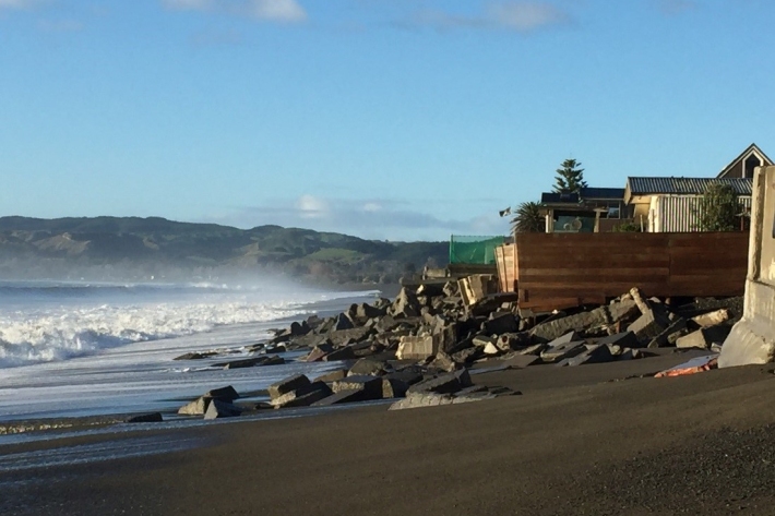
Sea levels and sea-level rise
Education ResourceOne of the major consequences of climate change is rising global sea levels. -
Scientists set to delve into the secrets of the Cook Strait mega-canyon
News article06 June 2017