-
Check Clean Dry actions
The Check Clean Dry Campaign aims to stop the spread of freshwater pests by encouraging people going through more than one waterway to check, clean and dry their gear in between. -
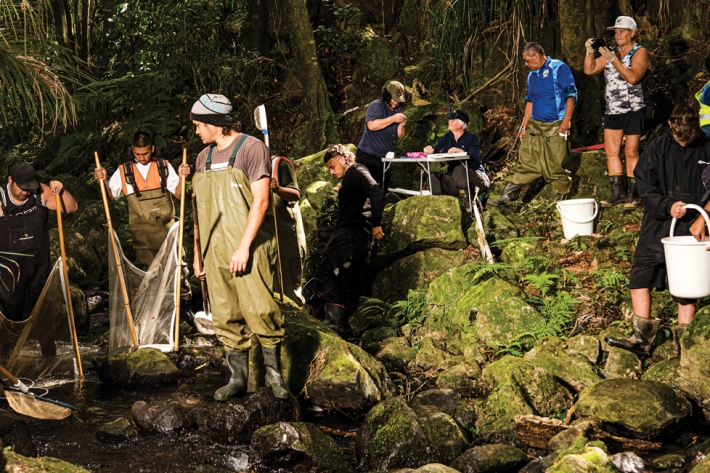
Protecting our taonga together
Feature story04 August 2021Alex Fear looks at the Cultural Keystones Species research programme, a research partnership that grew out of the vision of a Ngāti Hau kaumatua. -
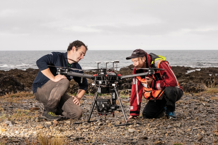
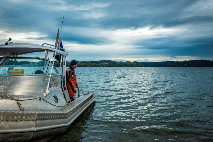
Supercharging the view from above
Feature story04 August 2021From the rocky shores of Wellington’s South Coast to the icy waters of Antarctica, NIWA scientists are combining drone technology with advanced computer skills to map, measure and analyse the natural environment as never before. Campbell Gardiner explains. -
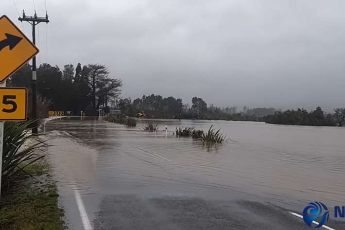
The largest flood flow ever measured
Media release29 July 2021Flood flows on the Buller River this month were the largest of any river in Aotearoa New Zealand in almost 100 years, NIWA measurements show. -
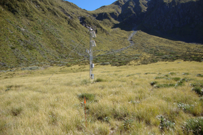
Murchison Mountains electronic weather station (EWS)
The Murchison mountains SIN station is located at 1140 m elevation in Fiordland National Park. Because of the low elevation, snow often comes and goes throughout the winter season. Snow records start in 2012. -
Castle Mount electronic weather station (EWS)
Castle Mount electronic weather station is at 2000 m elevation on an exposed site above the Milford Track. Records here begin in 2012. Strong winds limit snow accumulation during the winter. -
Mount Larkins electronic weather station (EWS)
The Mount Larkins electronic weather station is located east of the main divide near Glenorchy and Lake Wakatipu at 1900m elevation. -
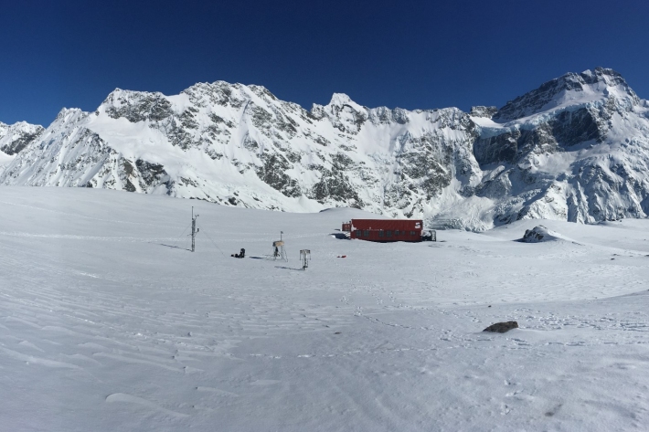
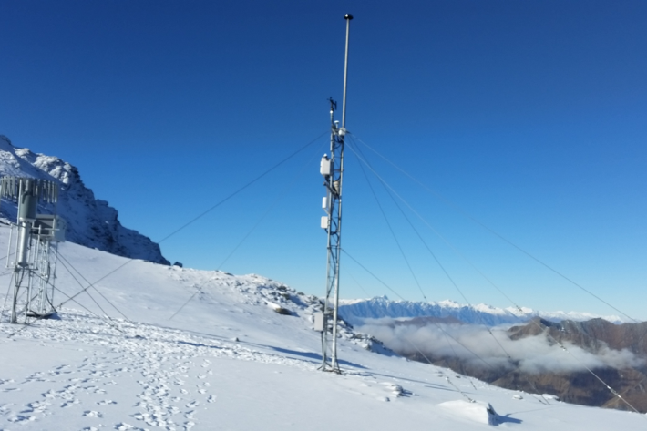
Mueller Hut electronic weather station (EWS)
Mueller Hut electronic weather station is at 1818m elevation and located in Mount Cook/Aoraki National Park. This site also measures solic precipitation and solar radiation. This is the deepest (~3m) of all the snow and ice network sites and records at this site start from 2010. -
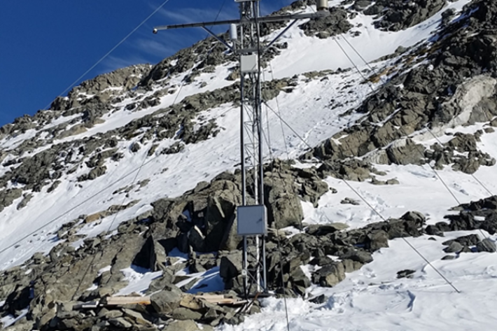
Mount Philistine electronic weather station (EWS)
The Mount Philistine site is located at 1655m elevation on the Main Divide near Arthurs Pass and Rolleston Glacier. It is a high precipitation area and snow records here start in 2010. -
Mahanga electronic weather station (EWS)
Mahanga electronic weather station (EWS) is on Mount Mahanga in Tasman. It is at 1940 m elevation near the Nelson Lakes. It's our most northerly South Island site and our snow records here date back to 2009. -

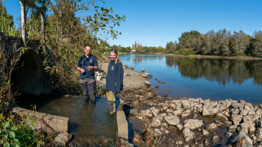
New weapon in fight against invasive aquatic weeds
Media release20 July 2021A combination of artificial intelligence and scientific ingenuity looks set to be the next step forward in protecting Aotearoa New Zealand’s lakes and rivers from invasive aquatic weeds.