PDF of this article (224 KB)

Michael Reid Robin Wybrow Craig Woodward
Scientists have probed the secrets of the lake sediments to help in the rehabilitation of Te Pātaka o Rakaihautū.
Ko Te Waka Uruao, Ko Rakaihautū te tangata tuatahi, Ko Te Pātaka o Rakaihautū te whenua nei.
The first man was Rakaihautū, his canoe was the Uruao, the name of this land is the Storehouse of Rakaihautū.
According to Ngāi Tahu tradition, a great waka – Uruao – arrived out of the mists of time to the shores of Te Wai Pounamu. The captain, Rakaihautū, bought with him the Waitaha, the first people to arrive and light the home fires of occupation in the South Island. Shortly after his arrival, Rakaihautū decided to create a more liveable landscape for those that were to follow. So with his great digging stick– his Ko – Rakaihautū carved out the great lakes, breathing life into the new land. He completed his work on Banks Peninsula with two lakes: Te Waihora, or Lake Ellesmere, and Te Roto o Wairewa, or Lake Forsyth.
When Rakaihautū surveyed the magnificence of his artistic endeavours on Banks Peninsula, the beauty overwhelmed him and he decided to stay. He took up his great digging stick for the last time, went into the hills above Akaroa Harbour and drove the Ko deep into the ground, where it turned into Tuhiraki (or as some know it, Mt Bossu) and it rests there still. As a testament to the work of Rakaihautū, and in recognition of the abundance and variety of kai or food that was found on Banks Peninsula until quite recently, the people named the area Te Pātaka o Rakaihautū – the great food storage house of Rakaihautū.
Setting the scene


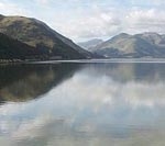
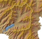
Te Roto o Wairewa/Lake Forsyth is a shallow coastal lake on the Canterbury coast south of Banks Peninsula. It is formed by the growth of a large gravel bar, known as the Kaitorete Spit, across a former estuary. The lake is currently fresh to brackish, depending on freshwater inflows and on whether the lake outlet is open to the sea. The lake is highly turbid due to high algal production and wind-driven sediment resuspension. It is prone to blooms of nuisance algae and toxic strains of cyanobacteria, particularly in summer.
Traditionally, Te Wairewa and its catchment have been regarded as the central food basket of the Ngāi Tahu in the Canterbury region. Extensive forests provided timber, fibre for building and weaving, as well as food and traditional medicines. Rivers, Te Wairewa itself, and the nearby ocean also provided a bounty of food resources including fish, particularly tuna (eel), molluscs, and marine mammals and waterfowl. These resources are known to the Ngāi Tahu as mahinga kai, meaning literally “to work the food”. This includes all the traditional systems, processes, rules, and regulations used to manage and protect the valuable indigenous resources.
Since the more recent European settlement of Te Wairewa, forest clearance, wetland drainage, pest and weed incursion, and the intensification of land use have had major effects on both terrestrial and aquatic environments. Te Wairewa Rūnanga has identified the rehabilitation of Te Wairewa and mahinga kai species as the priority environmental, cultural, spiritual, and economic issue within their area. The goal is to establish a Mahinga Kai Cultural Park in the area centred on the lake. This would be an area managed for rehabilitating the environment, gathering traditional food, and supporting innovative economic initiatives that involve the use of indigenous plants and animals.
Developing tools for rehabilitation
Rehabilitation of the lake and its catchment is fundamental to the process of developing the cultural park. Rehabilitation, by necessity, requires knowledge of past conditions as well as an understanding of the nature, degree, and causes of changes affecting the environment to be rehabilitated. This knowledge is not easy to come by. In the case of Te Wairewa, measured records of water quality and lake biota are limited to the past few decades, and so tell us little about conditions before the broad-scale changes that occurred with the European settlement of the region. Nevertheless, conditions within the lake at this time, and indeed for the full life of the lake, are recorded in the sediment that is deposited gradually – and more or less continuously – on the lake bed. A multitude of physical, chemical, and biological indicators reflective of the environment at the time of deposition are preserved in lake sediments. The process of using these indicators to reconstruct lake history is known as palaeolimnology.
Reconstructing Te Wairewa history

Scientists at NIWA and the University of Canterbury have examined sediments in Te Wairewa in order to reconstruct the history of the lake. Several sediment cores have been taken from the lake to establish stratigraphy. Radiocarbon dating and pollen stratigraphy provide a chronology for the sediment record. These indicate that the lake is over 7000 years old and that the sedimentation rate is highly variable, ranging from as low 0.1 mm/year before the arrival of Europeans to 2–3 mm/year in the last 150 years. Analyses of sediment particle size and of algal remains in the sediments (principally diatoms) indicate a gradual reduction in marine influence, probably reflecting the development of a barrier. A recent increase in salinity may be associated with the current practice of artificially opening the outlet to prevent flooding of surrounding farmland. The record also shows replacement of diatoms associated with submerged plants by diatoms living in the water column or sediment surface. However, the period of lowest sedimentation rate is also associated with poor preservation of diatom remains, making it difficult to interpret changes in parts of the record. This issue is being addressed by analyses of sediments using other indicators, including preserved plant pigments and fossil remains of invertebrate and macrophyte communities.
Results suggest that Te Wairewa has undergone substantial change in its 7000-year history. Salinity change is a feature of this history; however, changes in sedimentation rate and the extent of submerged plant communities, particularly over the past 150 years, are superimposed upon this. The record highlights the complex interactions driving change in the lake and supports the emphasis of the proposed Mahinga Kai Cultural Park on whole-catchment management. It also suggests that the practice of artificially opening the lake to control water levels will alter the ecosystem by allowing inflows of saline water and thereby changing biodiversity.
Further reading
Reid, M. (2004). Buying time for New Zealand’s lakes: learning to read lake history. Water & Atmosphere 12(1): 11-13.
Michael Reid, formerly a NIWA postdoctoral research fellow, is now based at the University of Canberra. Robin Wybrow is with Te Rūnanga o Ngāi Tahu in Christchurch, and Craig Woodward is a PhD student at the University of Canterbury.
Teachers’ resource for NCEA AS: Biology 2.5, 2.9; Science 2.2, 2.5, 3.5; Geography 2.1, 2.6. See other curriculum connections at www.niwa.co.nz/pubs/wa/resources
