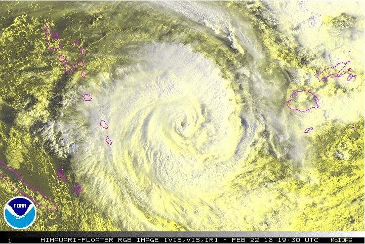
NIWA meteorologists continue to monitor the progression of Tropical Cyclone Winston, which, as of this morning, was producing 167 km/h winds and 204 km/h gusts about 350 km east of Vanuatu’s southernmost islands.
It has now been 12 days since the cyclone was named – the storm’s impressive longevity has been helped by abnormally warm sea-surface temperatures in the southwestern Pacific Ocean. Ocean surface temperatures near or above 30°C have enabled Winston to achieve the maximum intensity possible over its life cycle.
The next 24 hours
Over the next 24 hours, Winston will continue on a southward path into the open waters of the South Pacific while maintaining strength. Heading into Thursday, Winston is forecast to make a turn to the southwest then due west on Friday weakening as it goes.
The weekend
The cyclone is forecast to slow on Saturday, remaining in roughly the same spot about 1000km east of Queensland, Australia into early Sunday. Thereafter, confidence is increasing that the storm will take a southeastward turn into the Tasman Sea on a slow, but steady path toward New Zealand.
Impacts to New Zealand
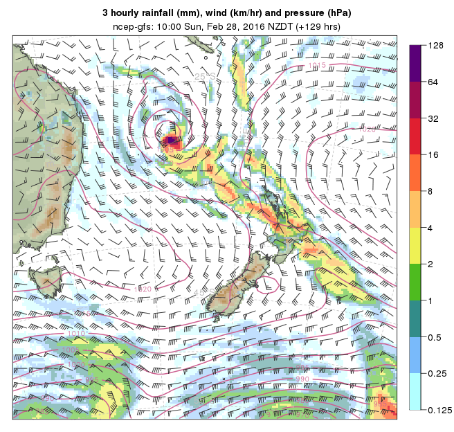
Tropical downpours may occur ahead of the storm across the northern North Island on Sunday into the early part of next week. This may result in localised instances of flooding and slips, especially in low-lying and poor drainage areas. The actual remnants of Winston could arrive during the early stages of next week, bringing a period of heavy rain, strong, gusty wind, and rough surf, most likely to the North Island.
While confidence is growing on the storm’s impacts to New Zealand, NIWA meteorologists consider this a rapidly evolving weather situation with forecast confidence rated medium. The next update should be available by midday tomorrow.
Further information