Marine scientists have long recognized the potential of using remotely-sensed data, most often acquired using a sonar system, as a proxy of biophysical indicators.
One research group that has supported and encouraged this line of research is the GeoHab group, an international association of scientists focusing on Marine Geological and Biological Habitat Mapping. GeoHab.org
In 2013, the need for a compendium on backscatter acquisition, processing and interpretation was highlighted during the annual GeoHab meeting in Rome. Subsequently, the Backscatter Working Group (BSWG) was created to produce the document “Guidelines and recommendations for backscatter measurements by seafloor-mapping sonars”. The document was released in May 2015, at the GeoHab conference in Salvador, Brazil.
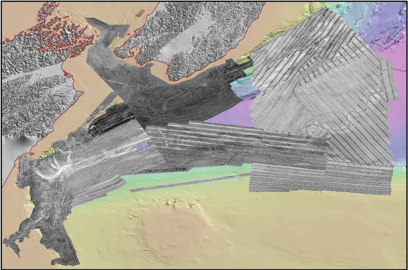
The founding ideas of the BSWG originate from the recognised lack of commonly accepted acquisition procedures and processing methodologies of backscatter data recorded with multibeam echosounders (MBES). Likewise, a shortage of documentation and literature pertinent to backscatter theory and applied operations was recognised. The lack of consistency between the backscatter acquisition systems proposed by various manufacturers had also never been addressed. This lack of consistency (see image) was regarded as an obvious hindrance to the progress of backscatter science.
The vision of the BSWG is that: "Backscatter data acquired from differing sonar systems, or processed through differing software tools, generate consistent values over a same area under the same conditions; these data are scientifically meaningful and usable by end-users from all application domains (geoscience, environment, hydrography, industry, fisheries, monitoring, cultural…)".
Backscatter measurements by seafloor-mapping sonars - Guidelines and Recommendations
Xavier Lurton and Geoffroy Lamarche (editors)
Authors:
Xavier Lurton, IFREMER, Plouzane, France
Geoffroy Lamarche, NIWA, New Zealand
Craig Brown, Nova Scotia Community College, Dartmouth, Nova Scotia
Vanessa Lucieer, Institute for Marine and Antarctic Studies, Hobart, TAS, Australia
Glen Rice, National Oceanographic and Atmospheric Administration, Durham, NH, USA
Alexandre Schimel, Deakin University, Warrnambool, VIC, Australia
Tom Weber, Center for Coastal & Ocean Mapping/Joint Hydrographic Center, Durham, NH, USA
The aim of this collective report by members of the GeoHab Backscatter Working Group is twofold:
(1) agree on, and provide, guidelines and best practice approaches for the acquisition and processing of backscatter data from seafloor-mapping sonars; and
(2) provide recommendations for the improvement and further development of seafloor-mapping sonar systems for acquisition of backscatter data and related processing tools.
The document includes seven chapters coordinated by a lead-author and written by groups of specialists:
- Chapter 1: Introduction to backscatter measurements by seafloor-mapping sonars.
- Chapter 2: Background and fundamentals.
- Chapter 3: Seafloor backscatter user needs and expectationsa.
- Chapter 4: Backscatter measurement by bathymetric echo sounders.
- Chapter 5: Acquisition: best practice guide.
- Chapter 6: Backscatter processing.
- Chapter 7: Synthesis and Conclusions on backscatter measurements by seafloor-mapping sonars.
The document is designed to reach a wide audience of scientists, engineers, operators and stakeholders all using sonar backscatter for seafloor-mapping applications. The BSWG report proposes fundamentals of the topic, a state-of-the art of techniques, and a number of recommendations for future systems and processing.
Download the report at: Backscatter measurements by seafloor-mapping sonars - Guidelines and Recommendations. A collective report by members of the GeoHab Backscatter Working Group. [PDF format]