PDF of this article (53 KB)
One of NIWA’s aims with this magazine is to contribute to science education in New Zealand. To this end we distribute Water & Atmosphere without charge to New Zealand high schools. Articles are assigned ‘Curriculum Connections’ to indicate which of the NZ NCEA Achievement or Unit Standards they can complement as a classroom resource. These links are assigned by Royal Society of New Zealand Teacher Fellows who are working during the year with NIWA scientists.
The magazine and the Curriculum Connections are also available online at www.niwa.co.nz/pubs/wa/ There you’ll find an archive of back issues beginning with September 2000 (vol. 8, no. 3). All online articles include a pdf of the printed version and the articles are indexed via the website’s search engine. The Curriculum Connections are compiled at www.niwa.co.nz/pubs/wa/resources/
Curriculum connections for this issue
| Pages | Article | Relevant NCEA Achievement Standards (AS) and Unit Standards (US) | Brief summary |
|---|---|---|---|
| 10–11 | From weather prediction to forecasting hazards | Weather Level 2 US20159 | Meteorological forecasting data feeds models for predicting a number of different hazards. |
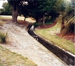
| 12–13 | Planning to avoid flood damage | Geography Level 1 US5083, Level 3 US5095, US5097, AS90703 | By combining river-flow predictions with refined topographic data, scientists are able to model areas at risk of flooding. |
| 14–15 | Flood forecasts for New Zealand communities | Geography Level 1 US5083, Level 3 US5095, US5097 |
NIWA’s flood early-warning system combines rainfall predictions and soil moisture to model when and where communities will be threatened by floods. |
| 16–17 | Earth Science Level 3 US6365 Geography Level 1 US5083, Level 2 US5090, Level 3 AS90703, US5095, US5097 |
Coastal communities are vulnerable to a host of natural hazards, most of which are likely to increase with climate change. |
|
| 18 | Geography Level 1 US5083, Level 2 US5089, Level 3 US5097, AS90703 |
A survey of community groups involved in caring for their coast reveals the processes and relationships that are key to a successful project. |
|
| 19 | Geography Level 1 US5083, Level 3 US5095 |
New models, plus data from NIWA’s videomonitoring network, are helping scientists understand and predict rip currents. |
|
| 20–21 |
On the lookout for tectonic faults and underwater landslides |
Earth Science Level 3 US21614, US6364, US6365 Geography Level 1 US5083, Level 2 US5089, Level 3 US5095 Science Level 3 AS90731 |
Sophisticated seafloor imagery helps model and evaluate the threat to the coast posed by earthquakes and tsunamis. |
| 22–23 | Tsunami sources in the Bay of Plenty | Earth Science Level 3 US6365 Geography Level 1 US5083,Level 3 US5095, US5097, AS90703 | By comparing evidence of past tsunamis with models of earthquakes and submarine landslides, scientists are learning the most likely sources and consequences of future tsunamis. |
| 24–25 |
RiskScape: a new tool for comparing risk from natural hazards |
Geography Level 1 US5083, Level 3 US5097, AS90703 |
Helps evaluate a region’s vulnerability by comparing models of hazards with information about regional infrastructure, assets, people, and activities. |