PDF of this article (173 KB)


A large part of Surf Life Saving New Zealand’s rescue and safety interventions are in response to rip currents. Giovanni Coco and Malcolm Green describe a new model that could make surf life savers’ task easier.
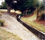
Rips are the curse of surf lifeguards and a challenge for oceanographers: how, when, and why do they appear? Rips can kill unwary swimmers and can also erode the beach, threatening property.
Common knowledge and new ideas
Rips usually occur in regular sequences down the beach; as waves get bigger, the number of rips may reduce, but those remaining grow in size. Oceanographers have put a lot of effort into predicting rips – their size, number, and location as waves change – but we still cannot make entirely satisfactory predictions. For instance, although we are able to reproduce the development of rip currents and the associated channels with reasonable accuracy, we still don’t understand why in some instances rip currents develop and in others they do not. As a rule, the larger the incoming waves, the more likely the development of rips.
Recent research in collaboration with scientists at Universitat Politècnica de Catalunya in Spain and University of Nottingham in the UK shows that predictability of rip currents is strongly related to the overall configuration of the beach – the location of sandbars and channels, the position and slope of the shoreline – before the rip develops. So, in order to predict rips, we need to not only forecast waves but also predict accurately the overall changes in beach morphology, its shape and structure.
A predictive model
We’re testing our ability to forecast rip currents at Tairua Beach. Working with the large amount of data available through our Cam-Era video monitoring network, we’ve analysed five years’ worth of rip currents and hindcasts of wave characteristics (height, period, and angle) for the same period. From this we’ve developed a probabilistic predictor model. We’ve tested the model by sending forecasts five days in advance to Tairua Surf Life Saving Club for real-time scrutiny. Results from the predictor are encouraging: up to 75% of rips could be predicted.
This exercise has shown us that when the beach morphology changes significantly (for example, as a result of a storm), predictions are less likely to be successful. Though models that integrate hydrodynamics and morphological changes are extremely complicated, they are a necessary step to improve understanding of coastal systems and forecasts of rips and other coastal hazards.

The view from Cam-Era
For the past decade, NIWA’s Cam-Era video monitoring network has been collecting morphological and surf-zone data at beaches around New Zealand. Though popular with surfers and ex-pat Kiwis homesick for a look at the beach, the network’s purpose is to record how beaches change under different wave conditions.
Read about Cam-Era and see images from around New Zealand at: www.niwascience.co.nz/services/cam-era/
Dr Giovanni Coco and Dr Malcolm Green are coastal oceanographers working at NIWA in Hamilton.
Teachers’ resource for NCEA Achievement Standards or Unit Standards: Geography Level 1 US5083, Level 3 US5095