

The growing popularity of a coastal lifestyle and the increasing risk of natural hazards are on a collision course. Rob Bell and Richard Gorman describe how hazards research can help us cope.
In growing numbers, people are realising their dreams of living by the sea, or at least spending more recreational time at the beach, and fuelling a buoyant coastal real-estate market. Mostly, the coast is an obliging environment, but the alluring coastal lifestyle can prove a dangerous liaison when natural hazards such as storms, waves, and tsunamis damage properties and endanger lives. Further, coastal and estuarine areas are facing increasing problems as global warming alters these hazards through climate change and sea-level rise. Coastal engineers have learnt through experience that taming the ocean’s wild moods can be both difficult and expensive. Rather than attempt to block out the sea, we need more focus on controlling human development and activities to avoid or reduce future catastrophes.
How the coast functions and our response
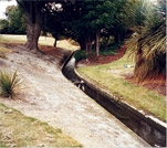
In its natural state, the coast acts as a buffer to the dynamic ocean colliding with a fixed landmass. The coast must at times absorb tremendous energy generated by large waves, severe winds, storms, and tsunamis – and take the rap over a very narrow buffer zone. Mostly, the coast absorbs this energy by wave-breaking in shallower water and by either flexing through the movement of large quantities of sand or gravel (causing beach erosion or accretion) or providing a barrier, such as a cliff or sand dune, high enough for gravity to halt the sea’s onslaught. When properties, infrastructure, and people get caught up in this buffer zone, these natural coastal processes become hazards. Often, the human response is ad-hoc coastal defences that can alter the natural character of the coast and limit public access. As NIWA scientists and engineers continue to unpack the complex response of coastal systems to hazards, we are helping planners and emergency managers work better with nature and prepare for climate-change effects.
What are these hazards?
Coastal hazards are caused by different mechanisms, producing ’drivers‘ that directly affect the coast. Coastal hazards can be grouped into three categories:
- coastal inundation (or flooding)
- coastal erosion (cut-back) and accretion (too much sediment)
- recreational and maritime hazards.
Coastal-hazard drivers come from storms, winds, sea-level changes due to climate variability (for example, seasonal and El Niño), and earthquakes that rupture the seabed (which can create tsunamis). For New Zealand, low-pressure storm systems and ex-tropical cyclones are the most common causes of coastal hazards, creating waves and higher seas (storm surge) that ride on top of the tide to generate a storm tide. Storms can cause havoc in coastal communities, through coastal flooding, wave overtopping of coastal margins, wave impacts on structures, and coastal erosion, and can disrupt recreational activities and shipping.
Climate change will affect three out of the five causes of coastal hazards. Even tsunamis, which are generated by geological processes unaffected by climate change, will eventually pose a slightly larger threat because they will ride on top of a higher sea level.
Reducing the risk
NIWA is working on several fronts to assist in reducing the risk – the probability of intolerable consequences – from exposure to coastal hazards. These include the development of a robust forecasting system for waves and storm tide levels, use of realtime monitoring to update emergency managers on storm tide, waves, and tsunamis, developing models for estimating potential damage to the built environment to guide decisions on risk reduction, and providing best-practice guidance manuals to assist planning in the face of climate change. All these tools and systems are grounded in NIWA’s hazard programmes that strive to better understand how and when coastal hazards occur, and how they will change in the future.
Forecasting
We can forecast waves and swell around New Zealand based on the same weather-prediction model as for floods (see ‘From weather prediction to forecasting hazards’). Winds over the ocean are highly variable, with calm periods interspersed with the passage of storms. The sea state produced by a storm depends not just on the wind speed, but also on the physical size and structure of the storm, and on how long the storm takes to pass. Once generated by winds in a localised weather system, the waves can travel for days. Longer period waves (or swell) can ride into a New Zealand beach, even on a sunny day, from storms thousands of kilometres away. The wave conditions at the New Zealand coast are a combination of these long-distance swells and waves created by local wind conditions.
At NIWA, we’ve developed numerical computer models for forecasting waves for any area around New Zealand. Initially, the model covers the whole globe to include all possible distant sources of swell. Then a model that operates in much finer scale (12-km grid) is nested inside the larger model, to produce wave forecasts up to 48 hours ahead. Similar models can develop a hindcast of wave climate going back over the last 25 years. Now, armed with an improved understanding of the wave climate around New Zealand, coastal resource managers have a better base for planning subdivisions that are prepared for coastal erosion or inundation, and ship operators and fishers can plan voyages more safely. A similar, parallel system has been developed for forecasting storm tide heights; it can provide warning of sea-flooding in low-lying coastal areas.
Guidance for planners
The other key to managing coastal hazards is avoiding or reducing risk through improved and informed planning when siting new buildings, roads, and facilities in the vulnerable coastal margin. Already, New Zealand faces increasing threats to some developed areas through unwise planning decades ago, when little was known of coastal variability. With government agencies such as the Ministry for the Environment, NIWA is developing guidance manuals for planners and engineers, particularly on how to incorporate climate change.
What now?
Although coastal hazards affect only some vulnerable lowlying coastal margins at present, the risk of damage and potential loss of life increases markedly as the value of coastal property booms and associated infrastructure is installed to service this growth. This risk will be further compounded by climate change as sea levels continue to rise and storms become more intense. These changes warrant better public and corporate awareness of coastal hazards and the crucial role the natural coastal buffer fulfils. As well, there must be a shift towards managing the human side of how we plan coastal development, rather than trying to sustainably manage and tame increasing coastal hazards.
Coast-wise
- The coastal zone forms a natural buffer between the landand the energetic sea.
- What’s natural at the coast can prove hazardous for peopleand property.
- Future climate change will only increase coastal hazards.
- Rather than build more coastal defences, the smart money is on managing the human side of the equation.
Further reading
Bell, R.; Coco, G. (2005). Wave-assisted coastal flooding. Water & Atmosphere 31(1): 16–17.
Planning for climate change effects on coastal margins Coastal hazards and climate change: a guidance manual for local government in New Zealand www.mfe.govt.nz/publications/climate/
NIWA’s sea-level monitoring network: www.niwascience.co.nz/services/sealevels/
Dr Rob Bell is a coastal engineer and Dr Richard Gorman is a coastal modeller; they both work at NIWA in Hamilton.
Teachers’ resource for NCEA Achievement Standards or Unit Standards: Earth Science Level 3 US6365 Geography Level 1 US5083, Level 2 US5090, Level 3 AS90703, US5095, US5097