NIWA's CHES (Cumulative Hydrological Effects Simulator) software tool predicts how water flows in a catchment will change with multiple water uses (e.g. direct abstractions or storage reservoirs) and what the consequences will be to in-stream ecosystems and reliability of water-take.
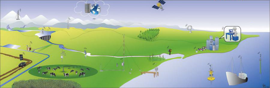
New Zealand's rivers are coming under increasing pressure to supply water for irrigation, hydro schemes, domestic and industry uses. At the same time, there are increasing values assigned to, and uses made of, the riverine environment (e.g. Maori values, tourism, fishing and other recreational pursuits). Also, added pressure for new water use can affect the reliability of water supply for existing users. So we need to make a balanced decision on how much river water can be allocated while sustaining the river environment and its ecosystem.
CHES simulates cumulative hydrological effects
- CHES (Cumulative Hydrological Effects Simulator) is NIWA’s unique software solution. It estimates the net changes to the flow regime throughout a catchment due to multiple water use schemes. It also quantifies the consequences for both the overall availability and reliability of the water resource and the residual flows that determine the in-stream environmental effects.
- CHES provides water resource managers with cost-effective, rapid, and flexible assessment of the cumulative effects of complex surface water allocation scenarios. It can even incorporate future climate change.
- CHES is easy to use and an essential tool for understanding the interplay of existing and new abstractions. It enables you to analyse the simulated or measured time series of residual river flows, and water takes, for user-specified scenarios. It is embedded into ArcMap as an add-in.
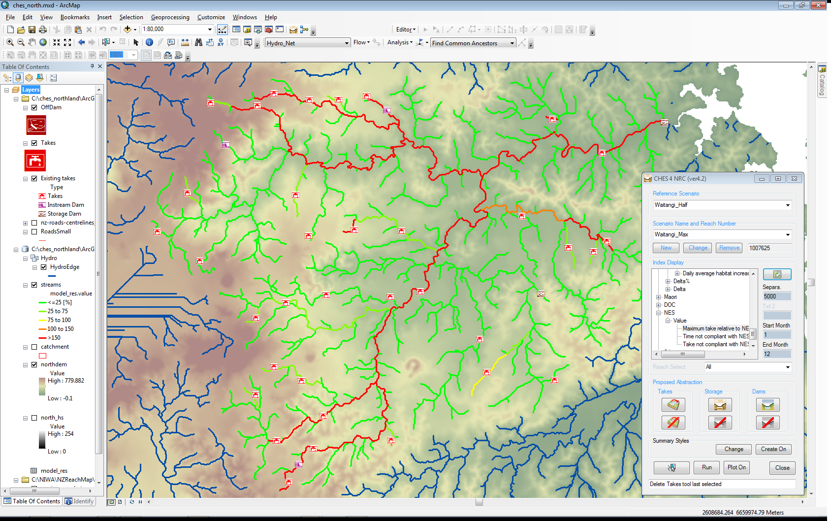
Reaches are colour coded based on total allocation in respect of proposed NES rules (National Environmental Standards), clearly showing several reaches where water has been over-allocated (red). Legend on left hand side (Layer: “streams”).
- CHES incorporates modelled river-flow time series for New Zealand's half-million reaches, and includes user-specified abstraction and storage options. It calculates the effects of water use by combining numerical water routing with operating rules. For example, placing a dam into a catchment uses a digital elevation model to calculate reservoir geometry and storage dynamics.
How does CHES work?
CHES works on user specified scenarios, such as:
- Natural - without any abstraction: ‘untouched’ river flows.
- Current - flow time series calculated with existing takes, input from a consent data base.
- Proposed - see the impact of potential abstractions on river flow, existing abstractions, and compounded environmental effects.
Many scenario variations are possible.
For every river segment across the project river network, CHES calculates a suite of statistics from the flow time-series generated for the user specified scenarios. For example: mean flow, minimum flow, MALF, and FRE3.
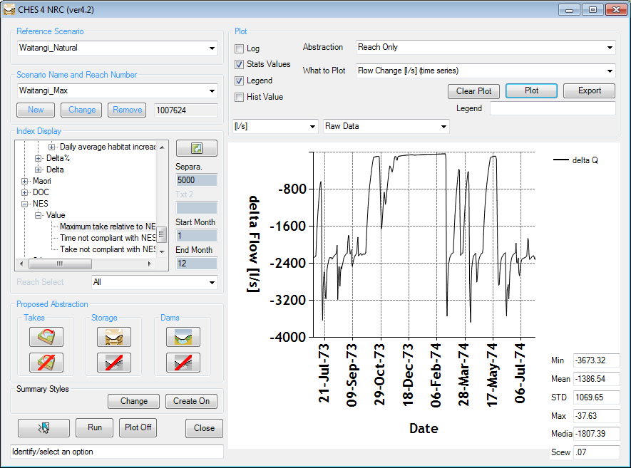
Water flow difference between natural scenario and consented scenario simulated for most downstream reach. Anything between 0 and almost 4 m^3/s were abstracted on a daily flows in the entire catchment.
Reliability of any existing and proposed abstraction is also determined and indicates possible over- or under-allocation.
View the spatially-distributed flow statistics in ArcMap. You can also feed the generated statistics or time series into linked modules that estimate and map environmental indices, such as expected periphyton levels or likelihood of river-mouth closure. NIWA can add new indices for you as you require them.
In the video below Principal Scientist Murray Hicks discusses the new modelling technology and how it works: