A study investigating the level of change needed to improve the state of Hawke’s Bay’s marine environment highlights the magnitude and frequency of interventions required for the seafloor ecosystem to recover.
The two-year regional study was part of a Sustainable Seas National Science Challenge in collaboration with Hawke’s Bay Regional Council and the Hawke’s Bay Marine and Coast Group.
It tested three scenarios involving reductions in bottom trawl fishing, reductions in sediments from rivers and introducing more closed fishing areas.
None of the scenarios came close to returning the seafloor habitat to its baseline condition of 200 years ago but compared to the current day, the options could double or triple the seafloor habitat.
The aim of the study was to provide a holistic approach to local marine management using the principles of ecosystem-based management.
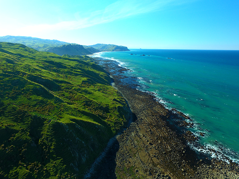
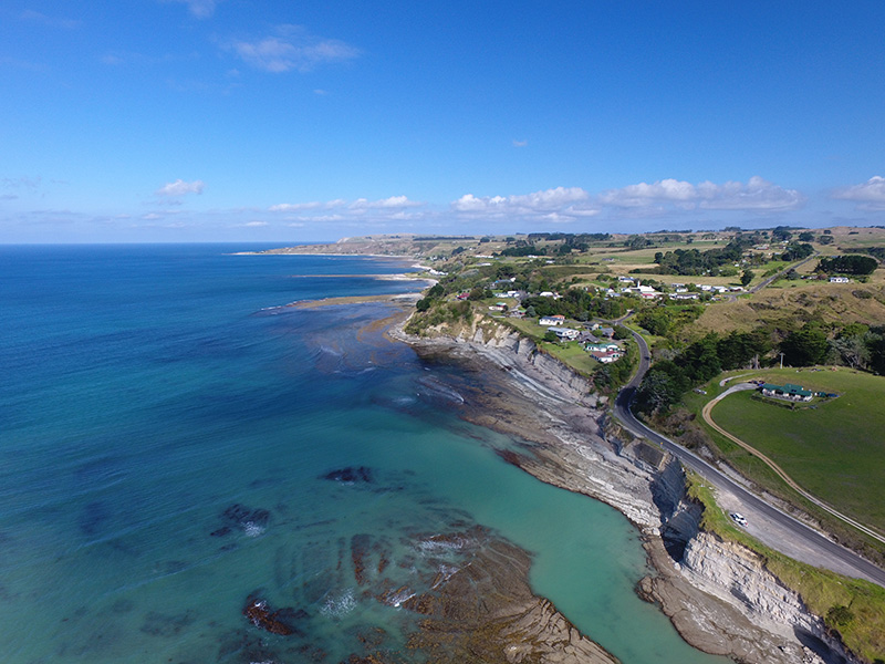
While the study focused on Hawke’s Bay’s marine habitat, most of New Zealand’s coasts and oceans are subject to similar pressures from the land and sea.
A NIWA marine ecologist, Carolyn Lundquist, was the lead researcher for the study.
She said improving the state of the Hawke’s Bay’s marine habitat would require a “ki uta, ki tai” approach, from the mountains to the sea.
“There are a lot of connections between freshwater and marine habitats. What’s happening on the land has a big impact on what happens in the marine environment."
“The scenarios we modelled showed that the things we need to do, to make improvements, are in our grasp but we need to go big, we need to work on all the things putting stress on the marine habitat.”
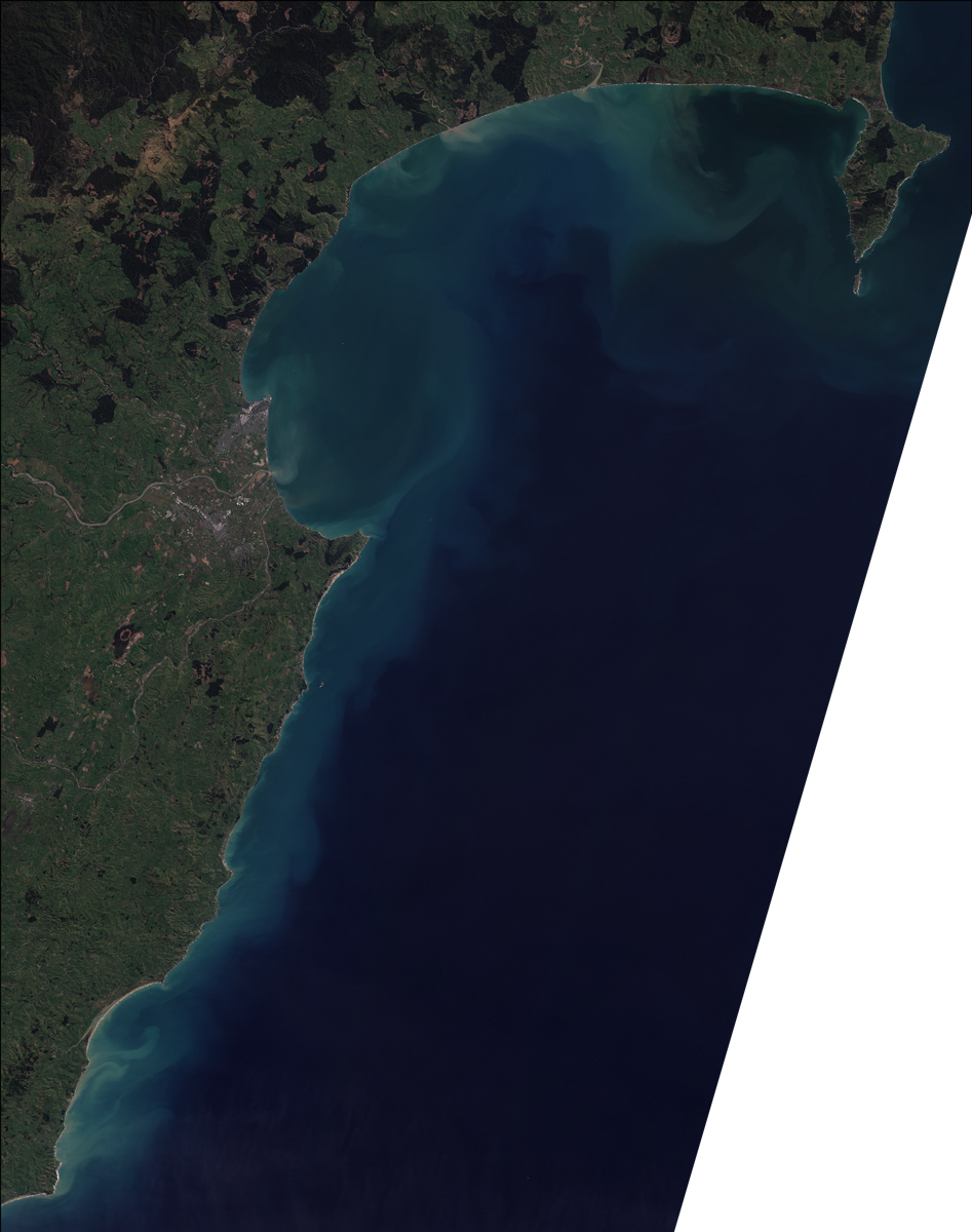
Research provided to the study showed sediments from nine river catchments flowing into the bay had significantly increased in the past 200 years.
Sediment in streams is natural but if levels are too high it can disrupt ecosystems by blocking out light and smothering important habitats.
Excessive sediments delivered to the marine environment can turn the seafloor to mud, reducing habitat for microorganisms and invertebrates.
Fencing off waterways, riparian planting near streams and using natural or constructed wetlands could all help reduce the level of sediments heading into rivers and consequently, Hawke’s Bay’s marine region.
Intense bottom trawl fishing also has the potential to disturb the seafloor habitat and lower the survival of benthic species.
Reducing fishing and increasing the number of closed fishing areas were among the options modelled in the scenarios, along with reducing sediments from rivers.
The scenarios were run over a 50-year timeline to estimate the scale of the recovery of the seafloor habitat in response to the changes.
The team designed what they thought were three very different scenarios in terms of the amount of fishing reduction, sediment reduction and/or closed areas, but all tended towards a similar result in seafloor recovery.
It is estimated that prior to European contact, the coverage of mature habitat on the seafloor was around 40%.
It is currently estimated to be about 12%. All three scenarios landed at about 17% but if there were no restorative interventions, it would further decrease to about 9% in 50 years.
The results of the study will help the Hawke’s Bay Regional Council to demonstrate how the health of the Hawke’s Bay marine environment has changed since the introduction of industrial fishing and land clearance.
It will provide information on the scale and combination of changes that would be required to support a healthy and functioning marine ecosystem that supports an abundant and sustainable fishery.
The information from this study will support exploring potential management and policy options for Hawke’s Bay’s marine environment.
It will help Incorporate ecosystem-based management into the development of the Hawke’s Bay Regional Coastal Plan - Kotahi, being developed by the Hawke’s Bay Regional Council.
FAQs
What is EBM?
Ecosystem-based management (EBM) is a holistic approach to managing the marine environment and its resources. It considers the best way to manage competing uses and demands without degrading the marine environment.
What is the Hawke’s Bay Marine and Coastal Group?
This is a collaborative group brought together to understand what information would be needed to support management of the Hawke’s Bay marine environment. It includes recreational and commercial fishers, tangata whenua, local industry and port, and government agencies and is chaired by Hawke’s Bay Regional Council science staff.
Why are biogenic habitats/benthic structure important in the marine environment?
Benthic (or seafloor) structure is the physical structure on the seafloor that animals and plants use as habitat. Some of that structure is created by organisms themselves and those habitats are called biogenic habitats. Many species form biogenic habitats, and they serve different purposes to keep an ecosystem functioning well. Larger biogenic organisms stablise the seafloor. For example, seagrasses and hururoa, or horse mussels, can settle on sediments and don’t need hard rock to start growing. Other species such as sponges, shellfish and tube worms help filter the water column to remove excess nutrients.
Not only is the physical structure on the seafloor important, plants in this zone are an important part of the carbon cycle because they help to take carbon out of the atmosphere.
How many closed fishing areas are there already in Hawke’s Bay?
There are four areas that have different levels of fishing ‘closures’: (1) The Springs Box near Clive is a voluntary area that can be closed to bottom trawling over summer; (2) The Wairoa Hard closed to net fishing; (3) within 2 km of the Mahia coastline is closed to commercial fishing; and (4) the ‘no-take’ Te Angaiangi Marine Reserve.