NIWA scientists will be in Hawkes Bay this week to map the seabed to measure the effects of Cyclone Gabrielle.
NIWA marine geologist Dr Joshu Mountjoy, says sediment from cyclone Gabrielle doesn’t just affect life on land.
"After weather events like this, we know that a huge amount of sediment will have come out of the rivers, and a lot of that will be sitting out there on the seafloor. Communities along the coast might be looking at all the sediment and debris in the ocean and wondering how it is affecting marine life."
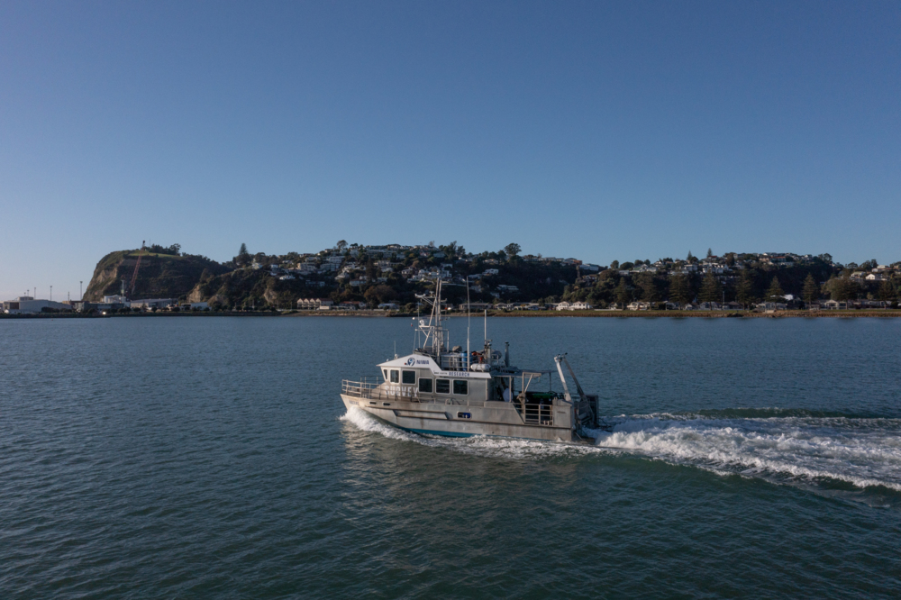
Starting April 18, scientists onboard the 13.9m-long research vessel, Ikatere, will be mapping around 200 square kilometres with a multibeam echosounder from 15 m water depth and deeper.
The vessel will be in and out of Napier’s port every day to complete the work and may be visible from shore at sites between Cape Kidnappers and Mohaka until Saturday, April 29.
Dr Mountjoy says previous monitoring in the area was carried out to help NIWA and the Hawkes Bay Regional Council identify which areas are important for biodiversity habitat, and to improve ongoing reporting on the state of the marine environment.
"We have maps already, so now we are going to see if anything has changed and establish a baseline to understand the impact of Cyclone Gabrielle on the marine environment," he says.
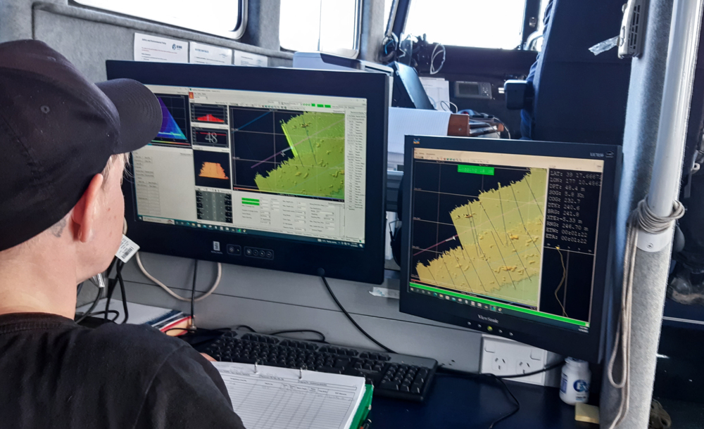
"It’s hard to anticipate what we will find. There have already been a few storm-generated wave events that we know can stir up sediment offshore and may have moved some of it around. We expect to see changes where rock or other structures have been smothered in sediment and we can image these with our multibeam bathymetry data.
"These areas are rich in biodiversity and an important coastal marine ecosystem, so we are very interested in what we might find."
NIWA has been involved in mapping vast amounts of New Zealand’s seafloor using multibeam echosounder equipment. These provide images of the seabed shape and contours of the seafloor and identify different seafloor physical characteristics.