A weekly update describing soil moisture patterns across the country to show where dry to extremely dry conditions are occurring or imminent. Regions experiencing significant soil moisture deficits are deemed “hotspots”. Persistent hotspot regions have the potential to develop into drought.
Recent rainfall and current soil moisture conditions:
North Island:
- Rainfall of 25-50 mm was commonplace across much of the east coast in the past week.
- Moderate amounts also fell in the upper North Island.
- However, meagre rainfall of 5 mm or less occurred in Manawatū-Whanganui and Wellington.
- This resulted in soil moisture increases along the east coast, but minor decreases in the western and lower North Island.
- The driest soils across the North Island, when compared to normal for this time of the year, are found in Waitomo District and northern Taranaki, while the wettest soils for this time of the year are found in coastal Gisborne and Hawke’s Bay.
- No hotspots currently exist in the North Island.
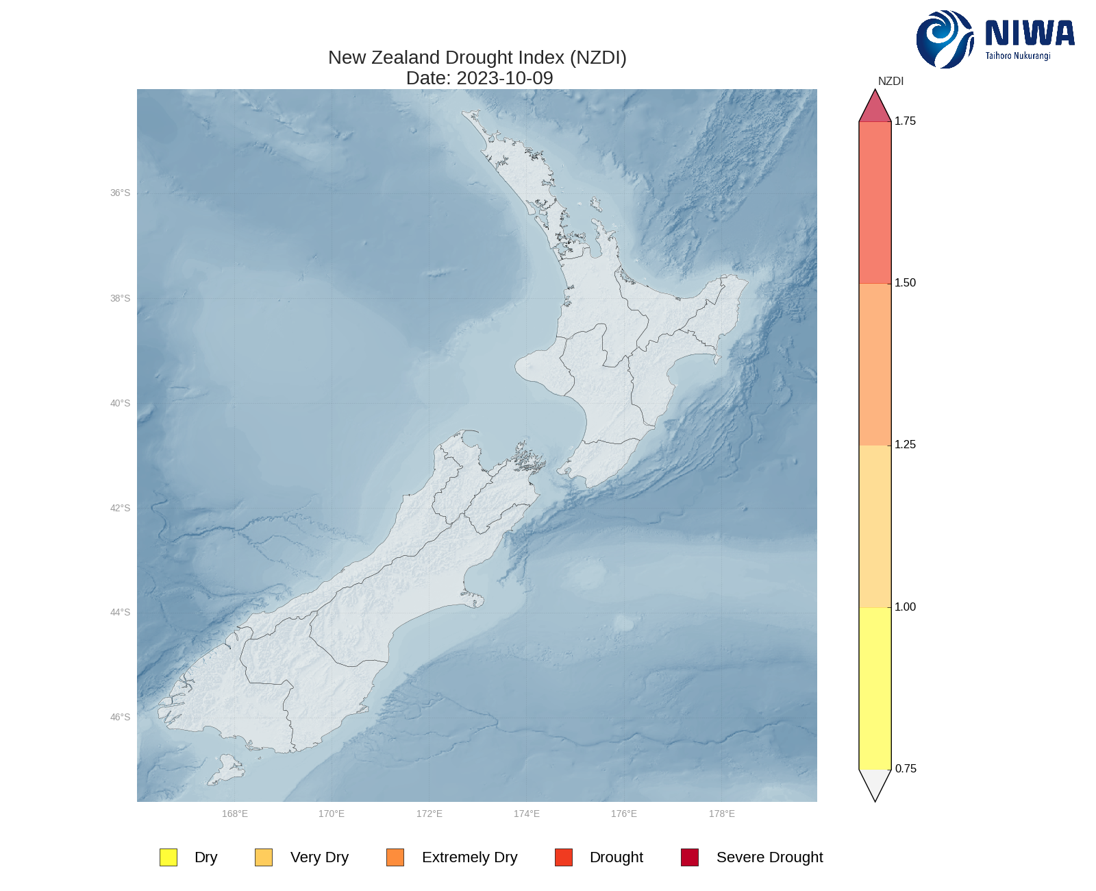
- As of 9 October, the New Zealand Drought Index (NZDI) map below shows that no unusually dry conditions are currently found across the North Island.
South Island:
- Rainfall of 25-60 mm occurred across most of the West Coast in the past week.
- While 15-25 mm fell in central Canterbury, most of the upper and eastern South Island received less than 10 mm of rainfall.
- This resulted in soil moisture decreases across a majority of the South Island, with the largest decreases observed in Tasman, Nelson, and Marlborough Sounds.
- The driest soils across the South Island, when compared to normal for this time of the year, are found along the northern coast from Tasman to Marlborough Sounds, while the wettest soils for this time of the year are found in northern Canterbury and interior Otago.
- No hotspots currently exist in the South Island.
- As of 9 October, the New Zealand Drought Index (NZDI) map below shows that no unusually dry conditions are currently found across the South Island.
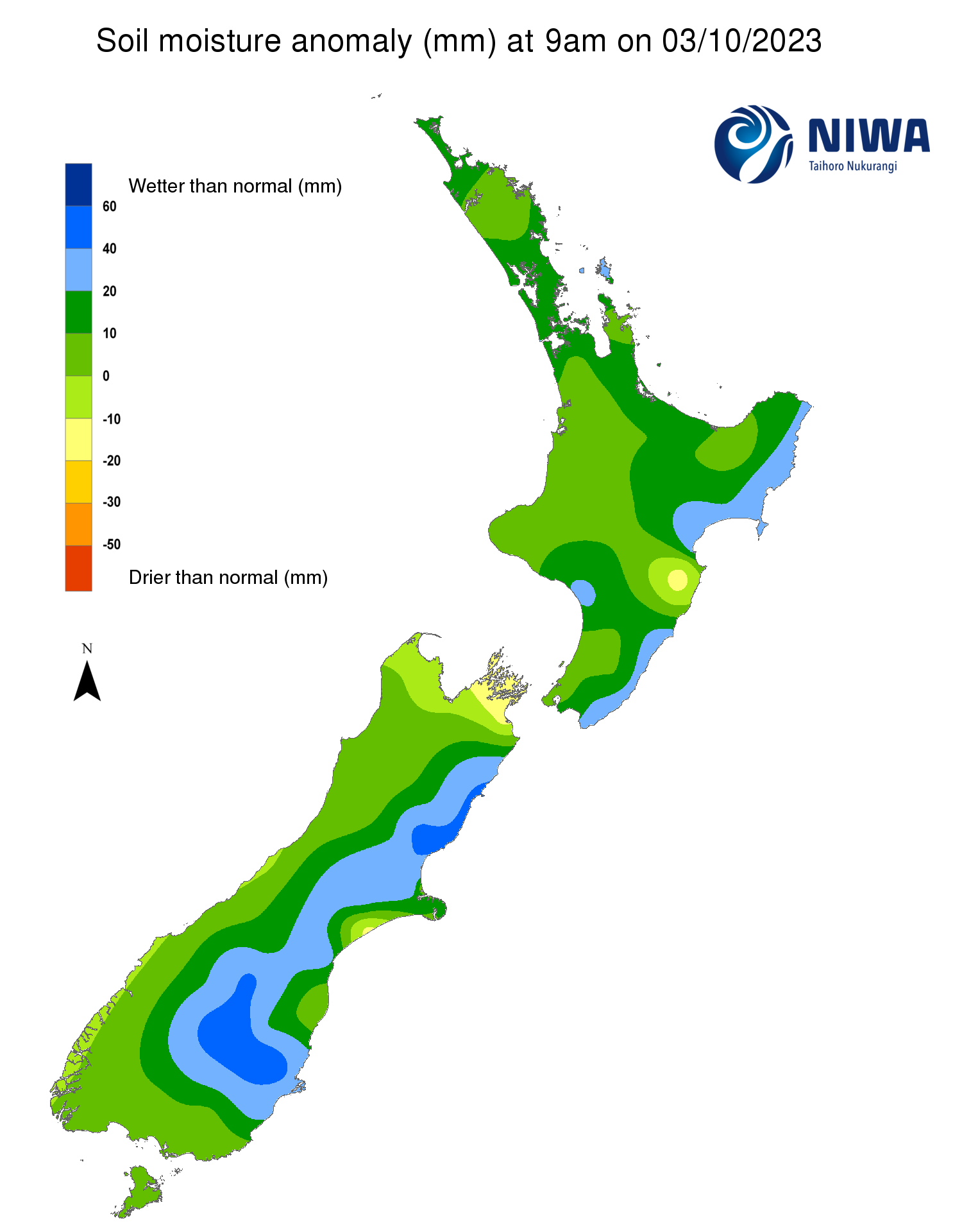
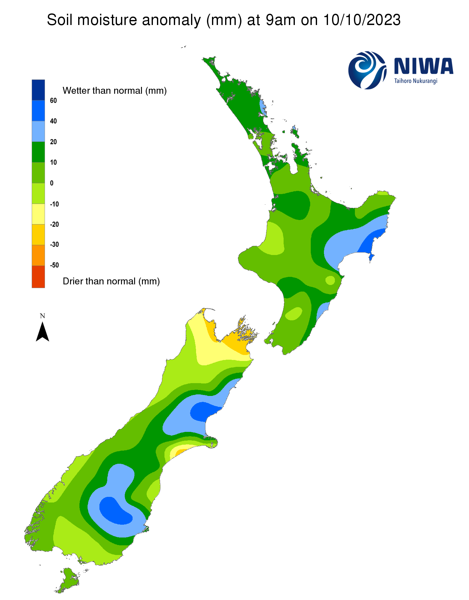
Soil Moisture Anomaly Maps, relative to this time of year. The maps show soil moisture anomalies over the past two weeks.
As of 9 October, the New Zealand Drought Index (NZDI) map below shows that no unusually dry conditions are currently found across the country.
Please note: some hotspots in the text above may not correspond with the NZDI map. This difference exists because the NZDI uses additional dryness indices, including one which integrates the rainfall deficit over the past 60 days. Changes are therefore slower to appear in the NZDI compared to soil moisture anomaly maps that are instantaneously updated.
The week ahead:
North Island:
- The next couple of days (12-13 October) will feature isolated, light showers in the western North Island, with generally dry weather elsewhere.
- From Saturday to Tuesday (14-17 Oct), there will be an increased chance for showers and rain in the western North Island, with the potential for some rain to reach the east coast late in that period.
- By the middle of next week there is a possibility that low pressure could bring moderate rainfall to the upper North Island.
- Weekly rainfall totals of 30-50 mm will be possible in the western North Island, but other parts of the island will likely see totals of 25 mm or less.
- Due to the expected rainfall in the next week, soil moisture levels may increase at least slightly in the western North Island, but little change is expected elsewhere.
- No hotspots are expected to form in the North Island in the next week.
South Island:
- Heavy rain will impact the West Coast from late Friday through Sunday (13-15 October), while moderate rainfall amounts will affect Southland and Otago. However, the rest of the east coast will remain mostly dry.
- High pressure is forecast to bring mostly dry conditions during early-to-mid next week, with only small additional accumulations in the West Coast.
- Weekly rainfall totals will range from 70-200 mm along the West Coast, with the highest totals located in the lower West Coast and Fiordland.
- In Southland and Otago, weekly totals of 30-50 mm will be possible, while the rest of the east coast receives less than 20 mm.
- Due to the expected rainfall in the next week, soil moisture levels are expected to increase in the West Coast and lower South Island, but small decreases may occur in Canterbury and Marlborough.
- No hotspots are expected to form in the South Island in the next week, but conditions may begin to approach hotspot status in eastern Marlborough.
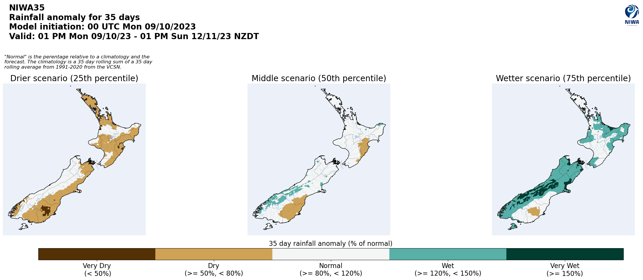
Long-term outlook (through mid-November):
- El Niño is expected to bring more westerly air flows than normal to New Zealand over the next several weeks.
- The drier (25th percentile) and middle (50th percentile) scenarios for rainfall over the next 35 days indicate that the West Coast of the South Island could see near normal to above normal rainfall, while the top and east of both islands are favoured to see near normal to below normal rainfall.
- However, in the wetter (75th percentile) scenario, even the east of both islands could see areas with above normal rainfall.
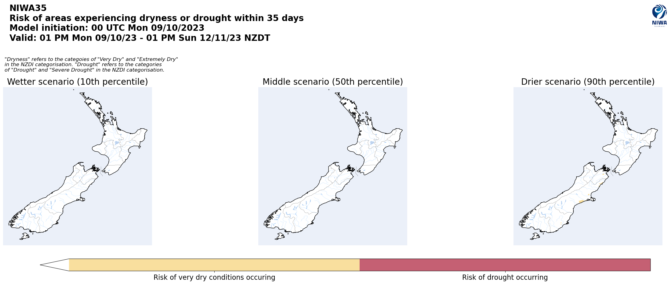
- Particularly in the drier rainfall scenario, there will be an increased chance to see dry conditions develop in at least small parts of the eastern South Island.