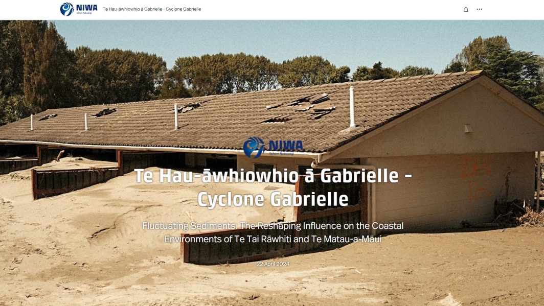
Introduction
Following Cyclone Gabrielle and other extreme weather events in 2023, government agencies and Crown Research Institutes including NIWA reprioritised some of their funding and research to help affected communities recover from these events and to enable all of Aotearoa to be better prepared in the future.
Additional government investment was made available for urgent scientific research and data collection to support the extreme weather response. This includes the Ministry for Business, Innovation and Employment (MBIE), which set up the new Extreme Weather Research Platform, with projects led by NIWA, GNS Science, Manaaki Whenua Landcare Research, Resilience to Nature’s Challenges National Science Challenge, University of Auckland and Auckland UniServices Ltd.
Below are summaries of NIWA-led projects that are contributing to understanding of and response to these extreme weather events:
Impacts on marine environment – coastal ecosystems
This project will focus on the nearshore marine coastal zone and use various tools (remote and in situ) to detect the immediate impacts to key marine ecosystems.
Cyclone Gabrielle significantly impacted the Hawke’s Bay and Tairāwhiti nearshore marine coastal zone, an area of vital social, cultural, aesthetic and economic importance. The mobilisation of sediments and debris associated with these events has significant consequences to the receiving catchments, and ultimately the ocean where this material is discharged.
The focus of this work is to quickly and effectively acquire data to determine the stressors (sediment, woody debris) and the long-lasting impacts on invertebrates and other bottom-dwelling organisms, fish stocks and breeding areas.
NIWA lead: Dr Leigh Tait
Partners:
- University of Canterbury
- University of Waikato
- Hawkes Bay Regional Council
- Gisborne District Council
- Department of Conservation
Rapid flood hazard assessment and modelling
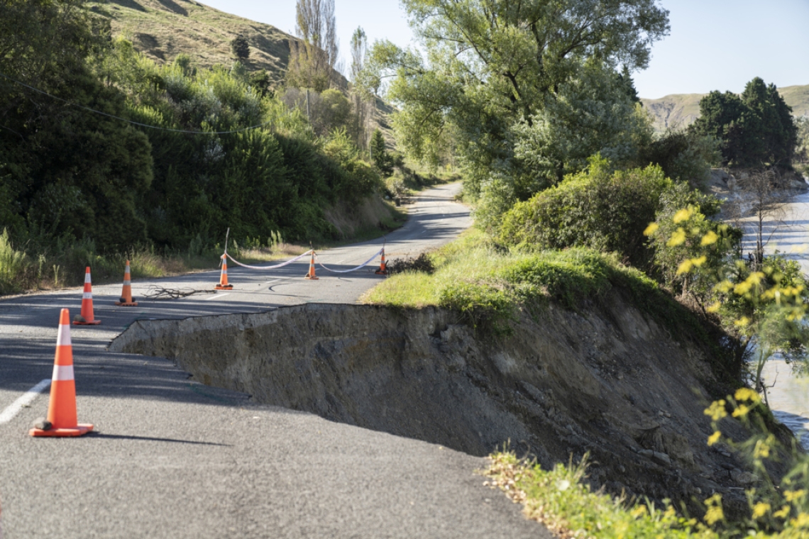
Cyclone Gabrielle’s greatest flood impacts were in Hawke’s Bay and Tairāwhiti regions, including loss of life and significant damage to buildings, land, infrastructure and primary production. In addition to the flooding, landslides generated huge amounts of sediment that have significantly altered the landscape in many areas, depositing 1-2 metres deep of sediment over several locations including the Esk, Dartmoor and Tangoio valleys.
Even more of this landslide sediment still remains in the upper catchments and will continue to affect the rivers and their geomorphology for the decades to come. The amount of rain that fell during this event exceeded the expected maximum rainfall amounts in many locations and floodwaters significantly exceeded the design specifications causing erosion on the outside edges of stopbanks. It is vitally important to understand what this event tells us about the likelihood of a similar event happening again in the near future, especially within a changing climate.
The researchers are analysing the Cyclone Gabrielle flooding and will use that information to model what future extreme flooding might look like in the future in the Hawke’s Bay and Tairāwhiti regions. They will look at how the sediment load in the rivers may have altered the effectiveness of the stopbanks and what might happen in the case of further stopbank breaches.
This information will enable the district and regional councils, iwi/hapū and local communities to make informed decisions about their futures and to protect themselves in the event of flooding in the coming winter rainy season. This is urgent work because it will assist the district and regional councils and central government to respond as quickly as possible.
The project team will also work to identify the next steps in ensuring Hawke’s Bay and Tairāwhiti regions are protected from future flooding and can build back with increased resiliency.
NIWA lead: Dr Emily Lane
Partners:
- WSP
- Gisborne District Council
- Hawke’s Bay Regional Council
- University of Auckland
- University of Canterbury
Immediate aftermath of Cyclone Gabrielle – helicopter LiDAR
The week after Cyclone Gabrielle, the NIWA hydrodynamics team joined forces with the University of Canterbury and Christchurch Helicopters Limited. They mounted a LiDAR instrument (Light Detection and Ranging – a way of rapidly capturing topographic data to build a 3D map) on a helicopter, and measured the post-flood topography over the Heretaunga Plains, the main Hawkes Bay rivers to the north of Napier and Tairāwhiti rivers. By comparing the data from these LiDAR observations with earlier LiDAR taken in 2020 they were able to locate and document stop-bank breaches, and to measure the sediment deposited by the flooding on the valley floor.
The team also analysed the extent of flooding from SAR (Synthetic Aperture Radar) satellite data. Analysis of the gathered information is ongoing, and ArcGIS software is being used to make data accessible and to help in future assessments of changes in river geomorphology due to the flooding.
NIWA lead: Dr Andrew Tait
Partners:
- University of Canterbury
- Christchurch Helicopters Limited
- Hawke’s Bay Regional Council
- Gisborne District Council
- LINZ
Immediate aftermath of Cyclone Gabrielle – flood extent and stopbank surveys
Immediately after the event NIWA also undertook an on-the-ground field survey of flood levels and stop bank breaches at locations stipulated by Hawke’s Bay Regional Council. They surveyed the depths, extent and bank breaches for flooding from the Tūtaekurī, Ngaruroro and Esk rivers and studied stop-bank breaching mechanisms and observed debris and siltation effects on the water levels. Water level data is used to assess the magnitude of the flood event and for calibrating hydrodynamic models and ground-truthing the LiDAR surveys.
The following video describes the flood survey work:
NIWA lead: Dr Graeme Smart
Partners:
- Hawke’s Bay Regional Council
- Environment Canterbury
Immediate aftermath of Cyclone Gabrielle – analysing sediment deposition
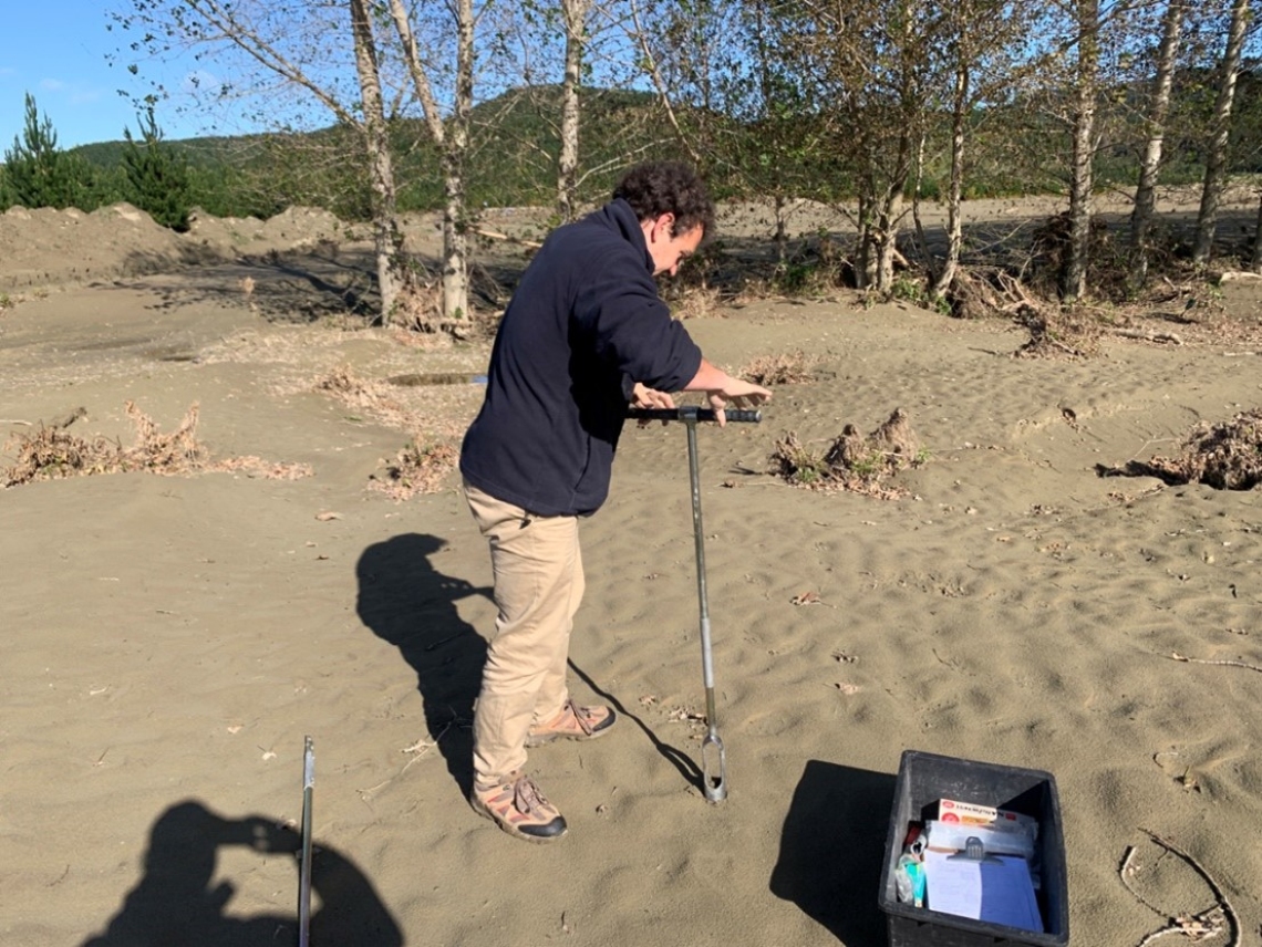
Sediment is one of the biggest challenges for communities facing the long road of recovery. It’s estimated that about eight million tonnes of river sediment and four million tonnes of hillside erosion lies in the Esk Valley alone.
Shortly after the cyclone NIWA researchers sampled 50 sites across the valley. Lab analysis of the samples is crucial for understanding the spatial size grading of deposited sediment for the whole Esk Valley. This information is helping inform clean-up efforts as well as increasing general understanding the dynamic of sediment deposition during these types of extreme events. The data will also provide unique information for developing a more accurate flood inundation model by updating the river bathymetry and floodplain elevation following the event.
NIWA lead: Dr Arman Haddadchi
Partner:
- Hawke’s Bay Regional Council
Assessing post-cyclone air quality across Tairāwhiti and Hawke’s Bay
The vast quantities of silt deposited by flooding have resulted in high levels of silt dust in the air across Tairāwhiti and Hawke’s Bay. In addition, Cyclone Gabrielle resulted in huge infrastructure damage, meaning councils and regulatory authorities need support to meet their legal requirements to monitor air quality.
To provide this support, NIWA’s air quality team is deploying mobile portable monitoring equipment, which will be in place until at least September 2023. The researchers are monitoring airborne particulates (PM10) and will be analysing samples for respirable crystalline silica and other substances that may have health impacts.
The timing of this initial response deliberately includes the winter season, as wood-burning for home heating – which is normally the biggest source of particulate matter and cause of local breaches of the National Environmental Standards for Air Quality – could increase, due to the state of the housing stock post-cyclone. Findings from this project will inform public health decisions.
NIWA lead: Dr Elizabeth Somervell
Partners:
- Hawke’s Bay Regional Council
- Napier City Council
- Te Whatu Ora
RiskScape for enhanced natural hazard risk assessment
This project will accelerate a version of NIWA and GNS Science’s multi-hazard risk model and information sharing platform, RiskScape for Cyclone Gabrielle recovery agencies and researchers.
The project involves setting up a customised multi-hazard risk modelling micro-site and information dashboard for agencies tasked with short and long-term recovery decisions for individuals, communities and sectors in Hawke’s Bay and Tairāwhiti.
Multi-hazard risk model operations enable decision makers to investigate present and future community or sector risk to different natural hazard impacts under:
- future redevelopment and growth scenarios
- climate change scenarios
- land use planning intervention options such as avoid, mitigate and adapt.
Modelled analyses on costs and benefits of interventions will provide a transparent evidence base to help communities and sectors make recovery decisions.
NIWA lead: Ryan Paulik
Partners:
- GNS Science
- Catalyst IT
- University of Auckland
- University of Canterbury
- Market Economics
- Neo Leaf Global
Remote sensing data collection
Sustainable long-term recovery of impacted communities and sectors needs to be informed by a sound understanding of present and future risk from multiple natural hazards. Regional geospatial imagery and LiDAR can assist in building a clearer picture of the full extent of the damage and longer-term impacts. The data has significant benefits:
- Access to high resolution imagery allows for analysis such as environmental impact assessment, past with present comparison mapping, and identifying affected rural properties/communities.
- Overlaying with additional layers like roads, rainfall over a period can help assess the nature of the impact and future risks, and possible interventions.
LiDAR collection is focussed on priority locations in the Hawkes Bay and Tairāwhiti regions. Aerial imagery will cover a broader North Island cyclone-affected areas, beginning with areas where no imagery exists.
In this project, NIWA is working with providers of remote sensing data and ensuring all such data is provided to Land Information New Zealand (LINZ). It will be hosted on LINZ data infrastructure and made freely available to the public for at least 5 years.
NIWA lead: Sarah McDermott
Partners:
- Land Information New Zealand
- Ministry for Primary Industries