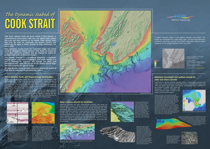
The dynamic seascape of Cook Strait is a recreational playground, a significant fisheries ground, a source of geological and oceanic hazards, and a challenge for engineers who manage the power and telecommunication cables that are laid on the seafloor and seek to harness the tides for future energy. For three decades marine scientists have been studying the seabed of Cook Strait to understand the processes that shape it. They have brought their knowledge together in this poster set comprising an informative poster and framable high resolution seafloor map.
These two posters (sold as a set) are approximately 85 x 60 cm and 71 cm x 85 cm respectively.
$30 (plus $5 for overseas orders)