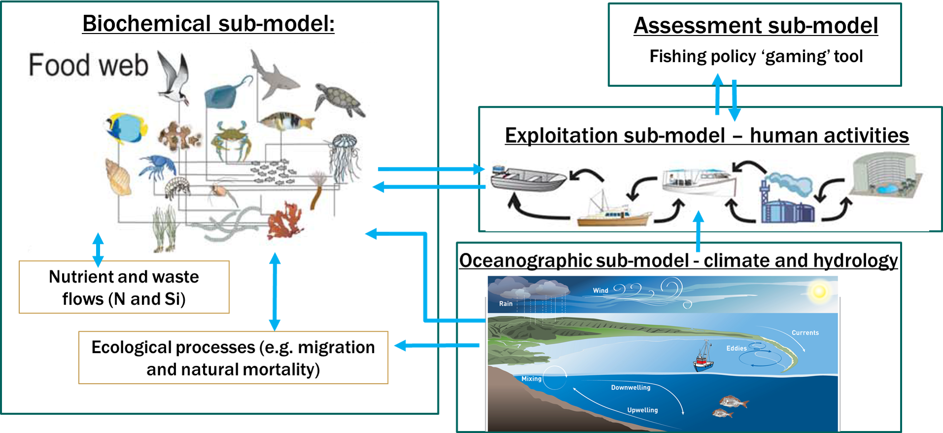
Atlantis is a 3D, spatially-explicit, trophodynamic ecosystem model that integrates biology, physics, chemistry and human impacts (e.g. the effects of fishing on ecosystem structure) to provide a synoptic view of marine ecosystem function.
Model summary
Atlantis is a full-system, ecosystem model that is being used across the world to assess the impact of environmental processes on the distribution and abundance of marine organisms, and to provide strategic advice to fisheries managers and stakeholders. The Atlantis modelling framework consists of sub-models that incorporate both the biogeochemical components of the marine ecosystem in question and the human realm into model predictions. Two Atlantis models are currently being constructed at NIWA, one for the Tasman and Golden Bays and another to represent the Chatham Rise area.
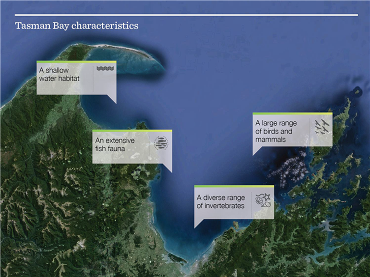
Tasman and Golden Bay (TBGB) Atlantis model
The Tasman and Golden Bay (TBGB) Atlantis model includes 51 functional groups that aggregate upwards of 171 single-species (from bacteria to seals). To represent the fishing industry in this marine ecosystem, we have included 12 commercial and recreational fishing fleets in the model, that together harvest 28 of the 51 model functional groups.
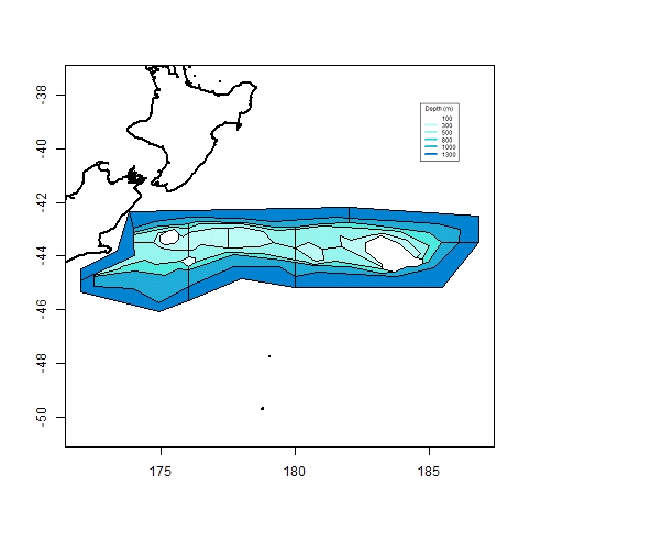
Chatham Rise
The Chatham Rise is a broad submarine ridge about 800 km long and 300 km wide that extends east from the New Zealand landmass into the southwest Pacific Ocean. It’s one of the most productive areas around New Zealand, due to the warm, nitrate-depleted subtropical water mixing with cold, nitrate-rich sub-Antarctic water.
Source code
Source code available at: CSIRO Marine and Atmospheric Research - Atlantis ecosystem model

