New Zealand is a marine nation responsible for one of the largest marine Exclusive Economic Zones on the planet but we are lagging globally in our access to tools for predicting ocean variables to improve management and use of marine resources.
Using a novel observational platform – ocean gliders—this research will observe and understand subsurface variations in temperature, salinity, oxygen and biological factors in water shallower than 200 metres – what we consider to be the shelf seas. The focus of this observational research stems from a lack of data and knowledge of ocean processes in depths of a few hundred metres, which are not covered by any other technologies.
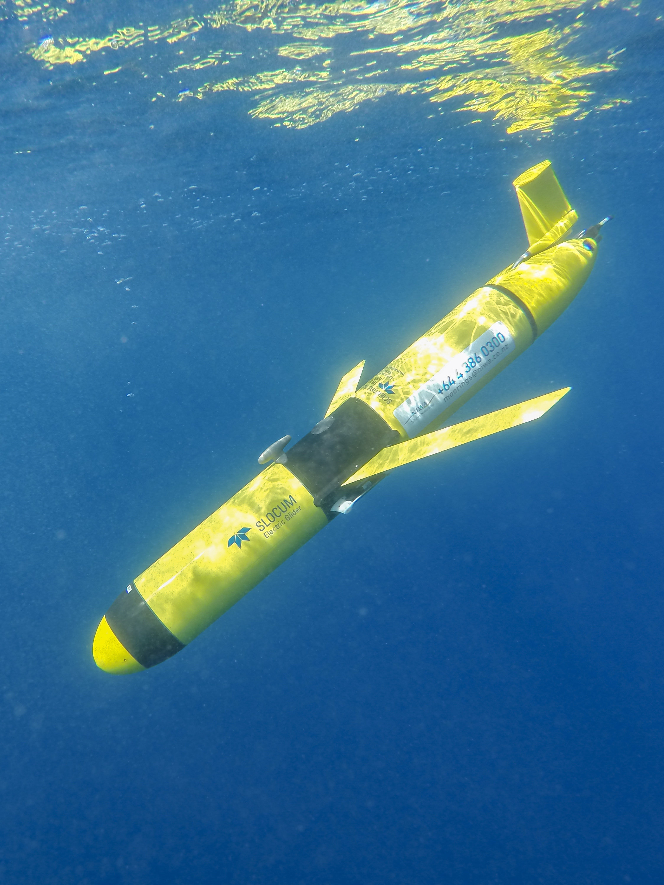
NIWA owns two Slocum gliders that are made in the US by Teledyne Marine. There are only around 600 Slocum Gliders being used in oceans around the world.
What is an ocean glider?
An ocean glider is a type of autonomous underwater vehicle (AUV) that uses a buoyancy engine to passively sample the ocean. The variable buoyancy allows the glider to sink or rise in the ocean. Wings on the glider convert vertical displacement into horizontal motion, resulting in a vertical saw-tooth dive pattern down to 200m, at a horizontal speed of about 1kmh. This efficient means of locomotion leaves most of the on-board battery power for operating the scientific instruments it carries. A glider deployment usually lasts about 30 days, during which time the glider will complete thousands of vertical profiles and cover over 500km (horizontally) of ocean.
The long-range and duration capabilities of Slocum gliders make them ideally suited for subsurface sampling of shelf seas. Gliders carry a variety of sensors to measure temperature, salinity, light, oxygen, turbidity and fluorescence - a proxy for chlorophyll - below the surface of the ocean. They can be programmed to sample for weeks at a time, surfacing to transmit their data to shore while downloading new instructions at regular intervals.
What do ocean gliders measure and what do these measurements tell us?
The gliders carry a number of sensors to measure physical and biological properties of New Zealand’s shelf seas. This data will help understand the dynamics of 'ocean stratification' – which is essentially vertical layers of different temperature and salinity in the water column that often flow in different directions and cannot be seen by satellites. Changes to ocean layers – or stratification – occur continually over days and weeks much like the different cloud patterns we observe with our eyes regularly. Scientists cannot see below the surface of the ocean, but ocean gliders can and they provide us with maps of 'ocean weather'.
By making observations of physics and biological properties at higher temporal and spatial resolution than ever before, gliders will ensure new understanding of New Zealand's oceans. Glider data will provide the building blocks for understanding how and where material such as nutrients, phytoplankton or sediment are transported in the ocean. An essential element for sustainable management of the vast marine resources around New Zealand.