Warm and dry to start, followed by cooler and unsettled conditions.
Overview
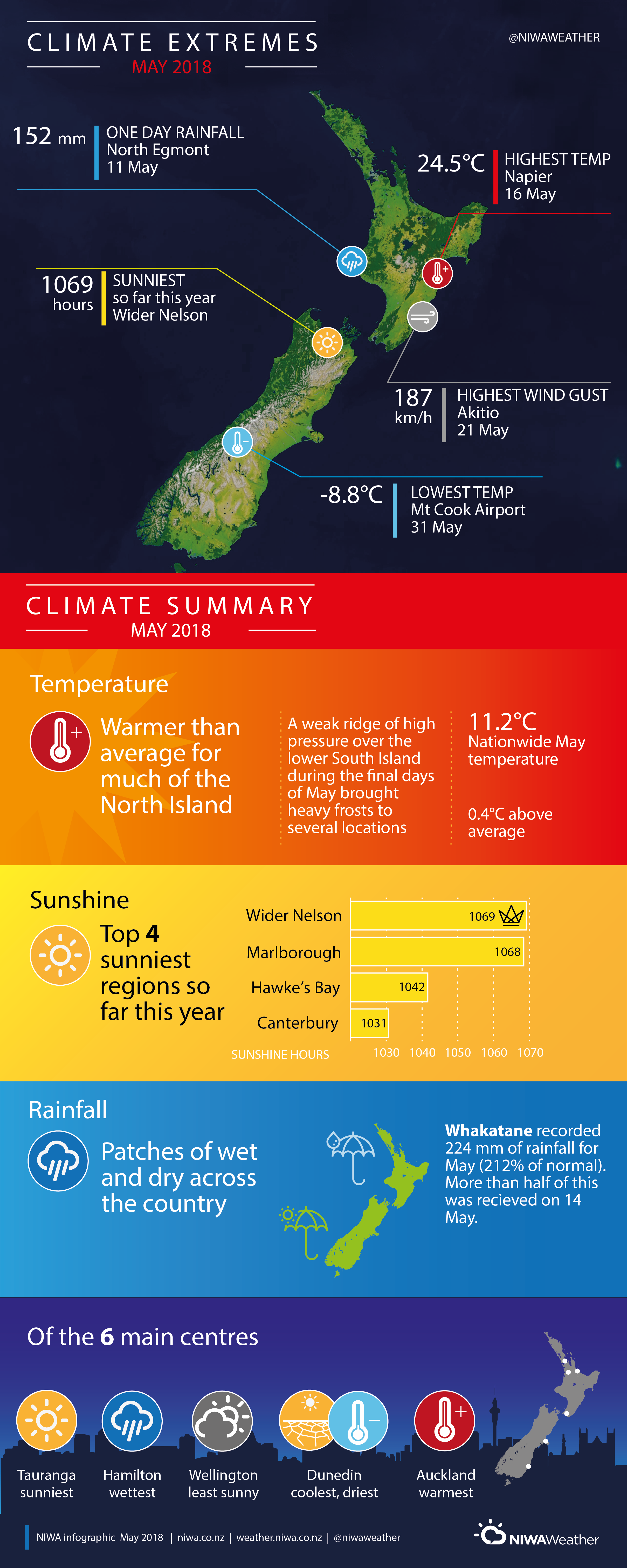
Overall, mean sea level air pressures were much lower than normal over and to the south of New Zealand during May. The first half of the month was relatively warm and dry throughout the country. However, during the second half of May, a blocking anticyclone became established over the southeast of Australia. This delivered a prolonged period of disturbed west and southwesterly winds over the country. Many fronts were embedded in this flow, which resulted in an unsettled spell of weather with bands of thunderstorms passing over the country (see Highlights and extreme events section for further details). A weak ridge of high pressure covered the lower South Island during the final days of May, bringing heavy frosts to parts of Central Otago, Southland, and the Mackenzie Basin.
The nationwide average temperature in May 2018 was 11.2°C (0.4°C above the 1981-2010 May average from NIWA’s seven station temperature series which begins in 1909).
Further highlights
- The highest temperature was 24.5°C, observed at Wairoa on 16 May.
- The lowest temperature was -8.8°C, observed at Mt Cook Airport on 31 May.
- The highest 1-day rainfall was 152 mm, recorded at North Egmont on 11 May.
- The highest wind gust was 187 km/hr, observed at Akitio on 21 May.
- Of the six main centres in May 2018, Auckland was the warmest, Tauranga was the sunniest, Dunedin was the coldest and driest, Hamilton was the wettest, and Wellington was the least sunny.
- Of the available, regularly reporting sunshine observation sites, the sunniest four locations in 2018 so far (1 January – 31 May) were Wider Nelson (1069 hours), Marlborough (1068 hours), Hawke’s Bay (1042 hours) and Canterbury (1031 hours).
Contact
Mr Gregor Macara, Climate Scientist Tel. 04 386 0509
Download:
- May 2018 Climate Summary information [PDF 500 KB]
- May 2018 Climate statistics [PDF 60KB]