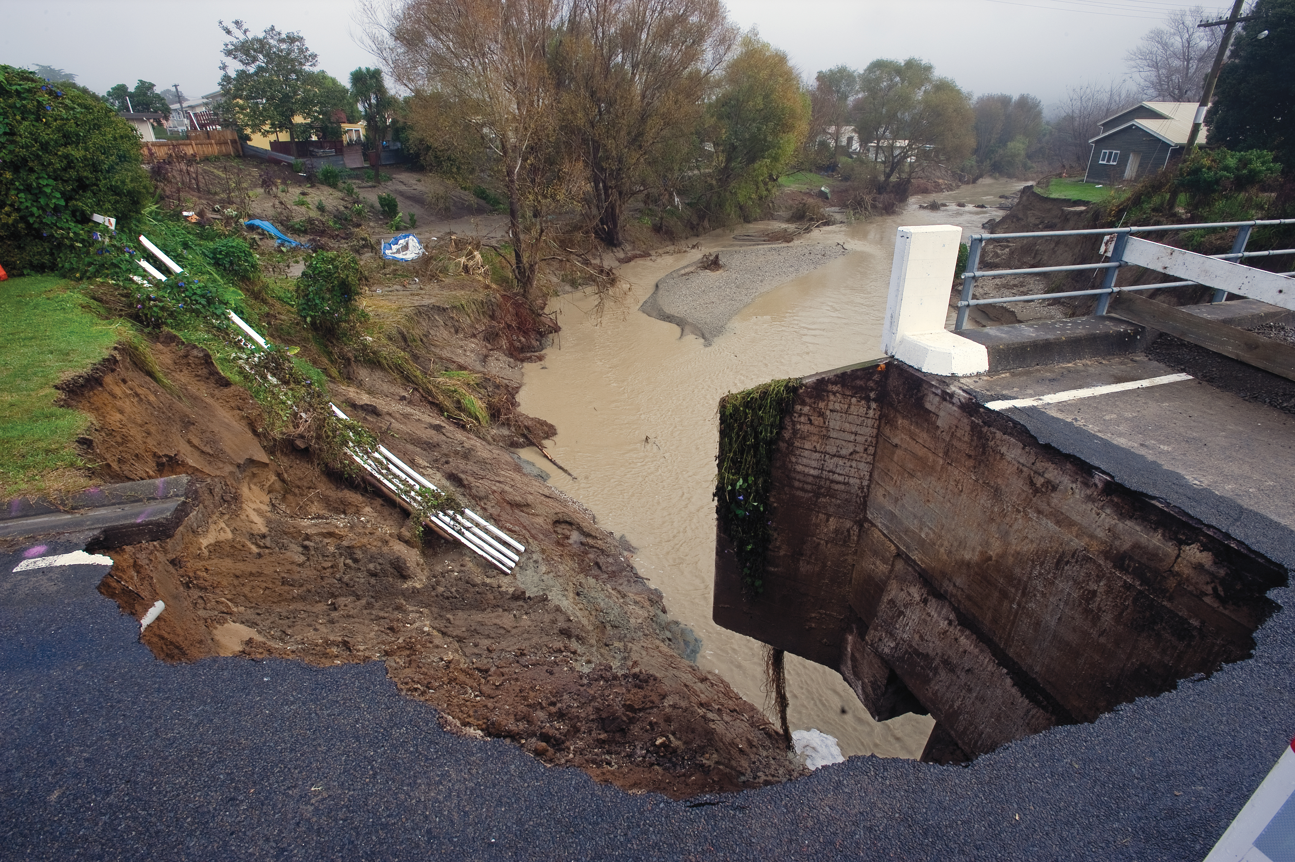
When designing infrastructure, such as a new bridge, to last well into this century, engineers must think worst-case scenario: specifications demand a structure so durable as to withstand the worst Nature might be expected to throw at it.
They might look at the rainfall records for the bridge's locality, and build for the maximums, but as climate scientists remind us, we can expect still more extreme storms in future, thanks to increasingly energetic weather systems.
Designing for an unpredictable future is now easier, thanks to NIWA's High Intensity Rainfall Design System (HIRDS). In a nutshell, it tells engineers how much rain they should design for at any location in New Zealand. What's more, it'll give them the probability of a really big downpour, and just how big it could be.
HIRDS, a web-based tool, helps design infrastructure for the future, says NIWA Engineering Hydrologist, Graeme Horrell. Its latest iteration, Version 3, he enthuses, "has a huge data set behind it, and it has the approval of its biggest users – regional councils – as well as hundreds of design engineers".
The applications are many: HIRDS can help design bridges and other road infrastructure, dams, or future-proof stormwater drainage systems, or just a supermarket carpark. "It's a key tool for all design work in New Zealand," says Horrell.
The system is simplicity itself: just go to the HIRDS page, then enter a street address, or the coordinates of a given location. Alternatively, you can enter a general locality, then, when the Google map comes up, just click on the location you need.
HIRDS takes it from there, providing storm rainfall depths over durations from 10 minutes to 72 hours, for once-a-year storms, or one-in-100-years, and every contingency inbetween.
A table appears on the screen with a series of depth, duration, and frequency statistics for rainfalls in minutes and hours.
"Let's say you want to design a carpark for optimum stormwater run-off," offers Horrell. "HIRDS will show you what rainfall depths you should expect, for example, during a 30-minute, one-in-five-year storm at that location".
Longer time frames are especially useful, he says, for assessing flood risk around rivers.
"This version of HIRDS is considerably improved, because we included regional council rainfall data in its development. It was then tested by regional council design engineers, who gave it the thumbs-up".
The data that drive HIRDS come from regional frequency analysis of annual extreme rainfalls from around 3000 sites in New Zealand. Both NIWA and regional council data sets were compiled by mapping median annual maximum rainfall (or index storm rainfall), then devising regional growth curves that relate rainfall at different recurrence intervals to that index rainfall. Then the two components are combined.
HIRDS can also help meteorologists and hydrologists with climate analyses, and the insurance industry can use it to assess flood risks, and set premiums accordingly.
Version 3 also lets users generate tables of high intensity rainfall for a given range of climate change scenarios, by entering projected temperature changes (those changes can be obtained from NIWA, or from the Ministry for the Environment's climate change guidance manual for that location for up to three periods.
The development of HIRDS was funded by the then Foundation for Research, Science and Technology, since integrated into the Ministry of Science and Innovation.