The Marine Environment Classification (MEC), a GIS-based environmental classification of the marine environment of the New Zealand region, is an ecosystem-based spatial framework designed for marine management purposes.
Developed by NIWA with support from the Ministry for the Environment (MfE), Department of Conservation and Ministry of Fisheries, and with contributions from several other stakeholders, the MEC provides a spatial framework for inventories of marine resources, environmental effects assessments, policy development and design of protected area networks.
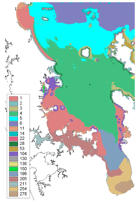
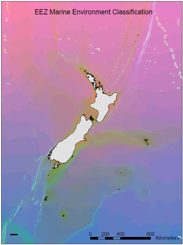
Two levels of spatial resolution are available within the MEC. A broad scale classification covers the entire EEZ at a nominal spatial resolution of 1 km, whereas the finer scale classification of the Hauraki Gulf region has a nominal spatial resolution of 200 m.
Several spatially-explicit data layers describing the physical environment define the MEC. A physically-based classification was chosen because data on these physical variables were available or could be modelled, and because the pattern of the physical environment is a reasonable surrogate for biological pattern, particularly at larger spatial scales. Classes within the classification were defined using multivariate clustering methods. These produce hierarchal classifications that enable the user to delineate environmental variation at different levels of detail and associated spatial scales.

Large biological datasets were used to tune the classification, so that the physically-based classes maximised discrimination of variation in biological composition at various levels of classification detail. Thus, the MEC provides a general classification that is relevant to most groups of marine organisms (fishes, invertebrates and chlorophyll) and to ecologically important abiotic variables (e.g., temperature, nutrients).
MEC datasets
The MEC has been published by MfE as datasets that are downloadable as well as viewable online:
The New Zealand Marine Environment Classification Overview is available on the MfE website.
The overview report covers the conceptual basis for the MEC and results of testing the classification:
- MEC Overview (PDF 2.7 MB)
An example of the MEC as a GIS layer in ARCView format is also available:
- MEC Example (ZIP 729 KB). Download freeware ARC view from ESRI.