LakeSPI (Lake Submerged Plant Indicators) is based on the principle that New Zealand lakes can be characterised by the composition of native and invasive plants growing in them, and the depths to which these plants grow.
Submerged aquatic plants are highly suitable biological indicators because they are easy to observe, reflect environmental conditions within a lake over an extended period of time, and bring a focus to the edges of a lake, where the greatest public interaction occurs.
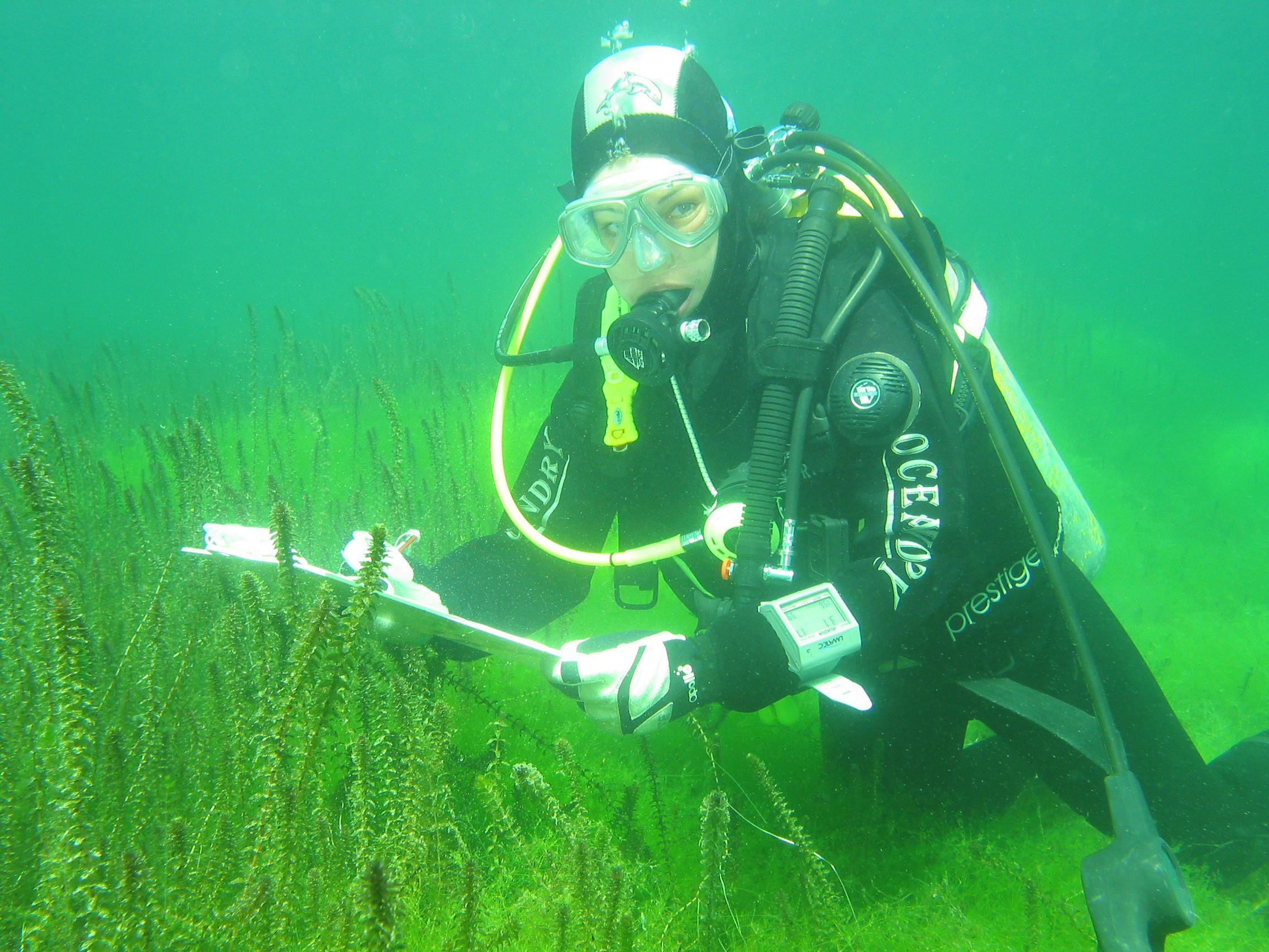
LakeSPI is carried out using scuba diving to record key information features about aquatic plant structure and composition within a lake.
Survey data is then used to generate three LakeSPI indices:
- Native Condition Index - Characterises the status of native vegetation within a lake.
- Invasive Impact Index - Captures the degree of impact from invasive weed species.
- LakeSPI Index - Provides an overall indicator of lake ecological condition.
A high Native Condition Index is favourable, while a high Invasive Impact index is undesirable. The higher the LakeSPI index, the better the overall health of the lake. For ease of reporting LakeSPI status, lakes are also classified into five lake categories according to the value of the LakeSPI Index: Excellent, High, Moderate, Poor, Non-vegetated. These categories support an MfE initiative for better national consistency in terminology and reporting. For more information see 'Reporting guidelines'.
LakeSPI has been developed for use in all lakes, except those where environmental conditions such as high altitudes, extreme salinity or pH affect the development of typical submerged vegetation. See 'LakeSPI limitations'.
The frequency at which LakeSPI can be carried out is determined by the lake's current condition, its vulnerability to change and its management objectives and use. For more information on how LakeSPI works, see 'LakeSPI method summary'.
LakeSPI methodology is freely available to lake managers and other interested parties via a user manual and a technical report and appendices.
-

LakeSPI method summary
A summary of the LakeSPI method.