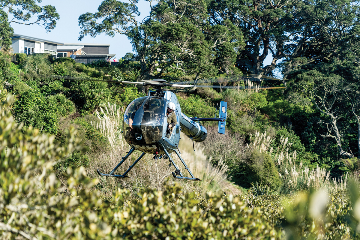
A helicopter sweeps into view over a mangrove forest in the Bay of Plenty carrying equipment vital to tracking the long-term health of our coastal wetlands.
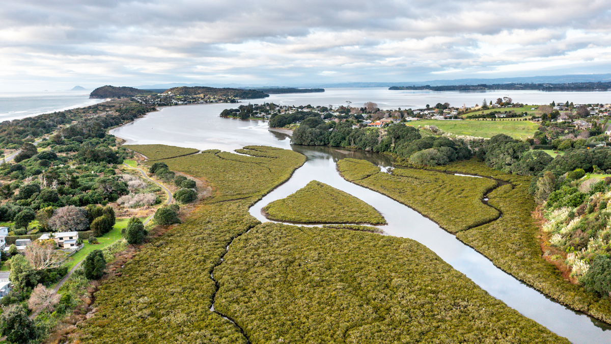
It is the first of three payloads carefully dropped at 100m intervals into the Athenree Estuary near Waihi Beach.
Three more are deployed into the estuary’s saltmarsh flats, about 1km away.
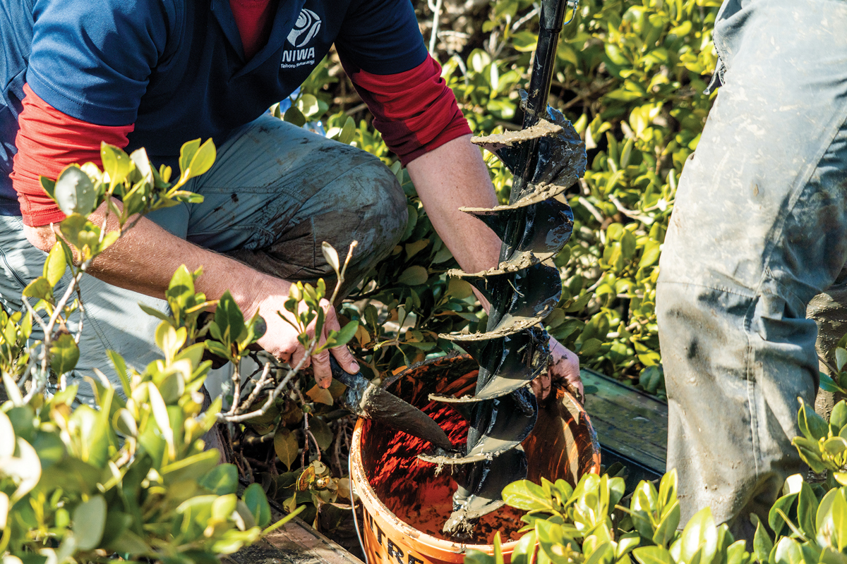
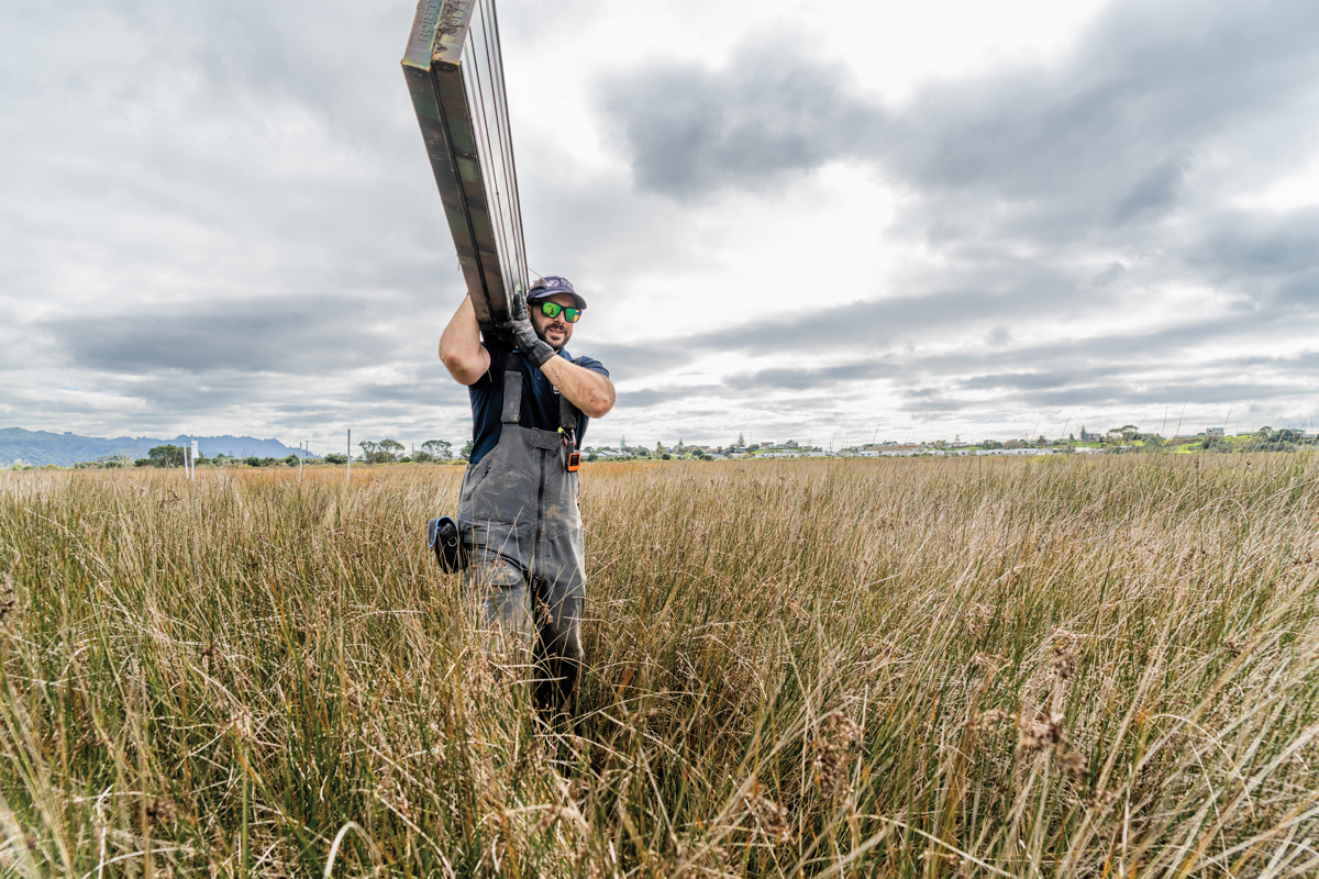
While the helicopter works above, researchers and technicians from NIWA and the Bay of Plenty Regional Council, battle knee-deep mud as they start assembling the first of six Rod Surface Elevation Table, or RSET, instruments.
These are sensitive measuring devices that can accurately monitor surface elevation changes in our coastal wetlands.
The information the RSETs gather will be crucial for assessing the future health of Athenree’s mangrove forests and saltmarsh habitats.
The substrate that mangroves and saltmarsh plants grow in must keep pace with sea-level rise. If the sea rises too quickly and the buildup of the substrate below fails to keep pace, they will die.
And the survival of this sensitive estuarine habitat, and its counterparts around New Zealand, is critical.
It functions as a long-term sink for stormwater contaminants, supports biodiversity and provides nurseries for estuarine and coastal fish species.
Mangroves also mitigate coastal erosion and flooding by absorbing the impact of storm waves, extreme tides and tsunami.
People living nearby need to understand how these important habitats are changing and what can be done to ensure the longevity of our estuaries.
The field team secures the RSET receiver unit into the muddy estuary floor.
In a couple of months, when the site has settled, the researchers will return to attach the sensitive measuring device to the receiver.
It’s a portable horizontal arm with a series of nine vertical pins which can measure minute changes in surface elevation. The device can swing around on the receiver to take measurements at the north, south, east and west positions.
In the following days, six more RSET monitoring sites are installed at Ōhiwa Harbour in the Eastern Bay of Plenty.
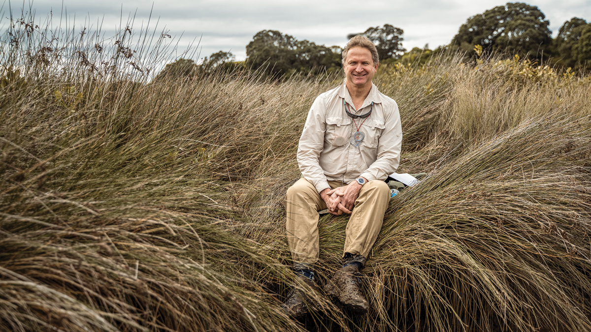
Both projects are led by NIWA Coastal and Estuarine Physical Processes scientist, Dr Andrew Swales, who was involved in installing New Zealand’s first RSETs in mangroves in the Firth of Thames.
NIWA has been contracted by the Bay of Plenty Regional Council to install these latest instruments and the council will use the equipment to track the health of saltmarsh wetlands and shape their response to changing environmental conditions.
“This is an important opportunity to work with the regional council here in Athenree,” Swales says.
“The RSETs will give the council baseline information to manage these systems, understand the pressures on them around sea-level rise as well as what’s coming in from the catchment in terms of sediment.”
Data from the monitoring stations will also inform wider coastal wetland research in the NIWA-led Future Coasts Aotearoa research programme.
Swales is one of the research leaders involved in the five-year study which aims to provide tools and guidance to help rural communities around the country living in coastal lowland, adapt and prosper despite unavoidable sea-level rise.
“It’s about the whole balance between nature and society. Can we as a country adapt to sea-level rise in a way that balances the values and the needs of nature, as well as the needs and values of communities and society, and in a way that isn’t at the expense of one or the other?”
Swales says records going back a century prove sea levels are rising.
“What’s still up for debate is how we respond to that. And organisations like NIWA are trying to inform that debate in a constructive way, by providing the information needed by decision makers.”
Dr Christo Rautenbach is a specialist in coastal and estuarine modelling at NIWA. He leads the Future Coasts Aotearoa study, in partnership with his colleague, environmental social scientist Jordan Luttrell.
"Sea-level rise varies depending on the location. It’s not uniform, but it is inevitable that the sea will continue to rise," Rautenbach says.
“Will sea levels rise faster than first anticipated? That’s the big question, and we can’t say for sure just yet.”
Future Coasts Aotearoa is the first sea-level research programme to focus on New Zealand’s rural, lowland landscapes.
“Other research typically focuses on the built environment, without much consideration for farms, rural infrastructure and ecosystems.
“Current strategies, in lowland regions, are likely to fail because we don’t understand how sea-level rise will impact on natural habitat, and what the impact will be on productive land.”
Future Coasts Aotearoa involves 50 researchers, some from international agencies, and 11 stakeholder groups, along with local and central government, Waka Kotahi and the Department of Conservation.
It addresses the physical science behind sea-level rise as well as the social and economic impact that issues such as inundation and rising salinity levels will have on lowland coastal communities.
Case studies are being explored in Northland, the lower Waikato, Bay of Plenty and Canterbury where early engagement has begun with Māori and councils.
These study areas each face unique challenges posed by sea-level rise. Working with individual communities will help researchers determine the opportunities for adaptation across the country.
Data gathered will suggest what changes are likely in groundwater levels, salinity levels and wetlands. The information will improve our understanding of where and when the country will reach an “adaption threshold point”.
That’s the point when coastal communities will have to decide between managed realignment or managed retreat.
Realignment involves removing coastal protection and allowing an area to become flooded, creating a new wetland or salt marsh habitat.
Rather than relying on hard structures for defence, managed realignment depends on natural defences to absorb or dissipate the force of waves.
Future Coasts Aotearoa aims to show how these changes can be made while ensuring coastal communities can remain prosperous.
That’s the solution many councils are looking for, and some have already begun to plan for changes prompted by sea-level rise.
Bay of Plenty Regional Council is studying the rate and the effects of saltwater intrusion into floodplains used for farming. The results will determine when it will no longer be economically feasible to farm, and what the land could be used for instead.
The council also has a community-led funding initiative which supports three coastal hapū with their first steps of adaptation planning.
Thames-Coromandel District Council has 400km of coastline and is finalising its Shoreline Management Plan. It’s the result of three years of consultation and research to manage coastal hazards, coastal erosion and inundation.
Further south, Hawke’s Bay Regional Council is developing its Kotahi Plan to replace its Regional Policy Statement, Resource Management Plan and Coastal Environment Plan.
It has 350km of shoreline and Kotahi will have a focus on managing the coastal environment, human impacts on coastal and marine habitats as well as climate change, sea-level rise and inundation.
Rautenbach says Future Coasts Aotearoa research will provide the science needed by councils responsible for writing coastal management plans.
It will also give guidance to the Ministry for the Environment and will feed into ongoing national policy revision on sea-level rise and coastal adaptation.
“We are hopeful this will build resilience in New Zealand communities as we brace ourselves for the inevitable changes to come.”
This story forms part of Water and Atmosphere - December 2022, read more stories from this series.