Coming from the Japanese word 'harbour wave', tsunami are a series of waves – with wave lengths up to hundreds of kilometres between crests - caused by undersea seismic disturbances.
Causes of tsunami
Ground displacement (movement) due to undersea earthquakes is the most common cause of tsunami. However, they may also be caused by submarine landslides, volcanic eruptions and caldera collapses, and even large meteorite impacts.
Tsunami may travel across entire ocean basins. For example, an earthquake in South America could trigger a tsunami that could severely impact New Zealand. In the open ocean, a tsunami wave may only be a matter of centimetres high. Its height increases as it approaches shore and slows down, due to the water depth becoming shallower. Tsunami waves can be several to tens of metres high when they hit the shore.
Potential consequences of tsunami
Tsunami can cause serious flooding of coastal areas. Large tsunami may inundate many kilometres inland.
The waves which initially hit the coast, followed by flooding spreading inland, can cause serious damage to infrastructure (including buildings and roads), land, crops and livestock. They can also result in injury or loss of human life. Strong currents may also cause damage to ships and coastal infrastructure.
Incidences of tsunami in recent years
- 2011 Tohoku Tsunami - The Tohoku Tsunami took place on March 11, 2011, and was caused by a magnitude 9 megathrustearthquake approximately 32 km deep and 72 km off the east coast of the Oshika Peninsula of Tohoku, Japan (the fourth biggest earthquake since records began) . The tsunami waves generated reached 10 m in height, and in some cases washed up to 10 km inland. This tsunami had an impact over the whole Pacific with parts of the west coast of North and South America being hit by waves up to 3 m high
- 2010 Chilean Tsunami - The Chilean Tsunami was caused by a magnitude 8.8 earthquake of the coast of the Maule/Biobío Region in February 2010 (the sixth biggest earthquake since records began) . The tsunami caused deaths in Chile and a tsunami watch across the entire Pacific Ocean.
- 2009 Samoa Tsunami - The Samoan Tsunami was triggered by a magnitude 8.1 outer rise earthquake on the Tonga-Kermadec Subduction zone, in September 2009. Tsunami waves inundated parts of Samoa, American Samoa and Tonga causing the loss of 189 lives in these three countries.
- 2004 Sumatra/Boxing Day Tsunami - The Indian Ocean (Boxing Day) Tsunami was triggered by a massive (magnitude 9.1) megathrust earthquake off the coast of Sumatra, Indonesia (the third biggest earthquake since records began). It affected not only Indonesia but also Thailand, Sri Lanka, India and the Maldives, and caused over 230,000 deaths.
Remote tsunami
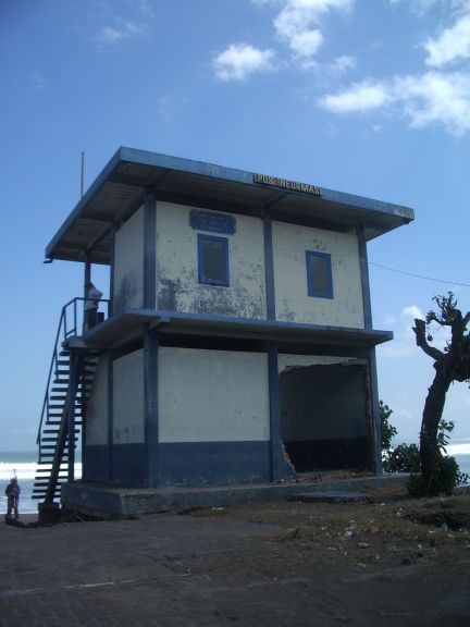
New Zealand is located well out into the Pacific Ocean in such a place as to be very vulnerable to remote tsunami generated by earthquakes or underwater landslides along the Pacific Rim, even as far as Alaska. Tsunami from South American sources probably pose the greatest “external” tsunami threat to New Zealand. A graphic reminder of this was the 22–23 May 1960 tsunami from Chile that produced a maximum height of 5.5 m in Lyttelton Harbour, and also affected other harbours along the east coast such as Gisborne (see picture). The largest known tsunami in New Zealand occurred in August 1868 following earthquake fault movement in Chile. This tsunami took 15 hours to travel to New Zealand and had a wave height that reached up to 8 m in parts of the east coast, Particularly Lyttelton.
Local tsunami
New Zealand is perhaps more at risk from local tsunami, generated “locally” by earthquakes and/or underwater landslides or volcanoes along our plate subduction zones off eastern New Zealand and south-west of South Island. This hazard is high because of the potentially large tsunami wave heights and lack of adequate warning. One example is the tsunami that hit the Gisborne region on 25 March 1947, with heights up to 10 m, probably caused by a combination of fault movement off the coast and an underwater landslide triggered by the earthquake. Unlike remote tsunami, little warning is possible for the pending arrival at the coast because of the close proximity of faulting, the continental plate subduction zone, and volcanoes along our coastline.
Tsunami research at NIWA
New Zealand is at risk from tsunami due to its long coastline and its position on the Pacific Rim of Fire. Steep undersea canyons such as the Kaikoura Canyon and the Cook Strait Canyon are also areas of potential submarine landslides which can cause dramatic local tsunami. NIWA's research into this natural hazard covers underwater earthquake faults and landslides, tsunami propagation and inundation modelling, post-disaster surveys and risk/loss assessment.