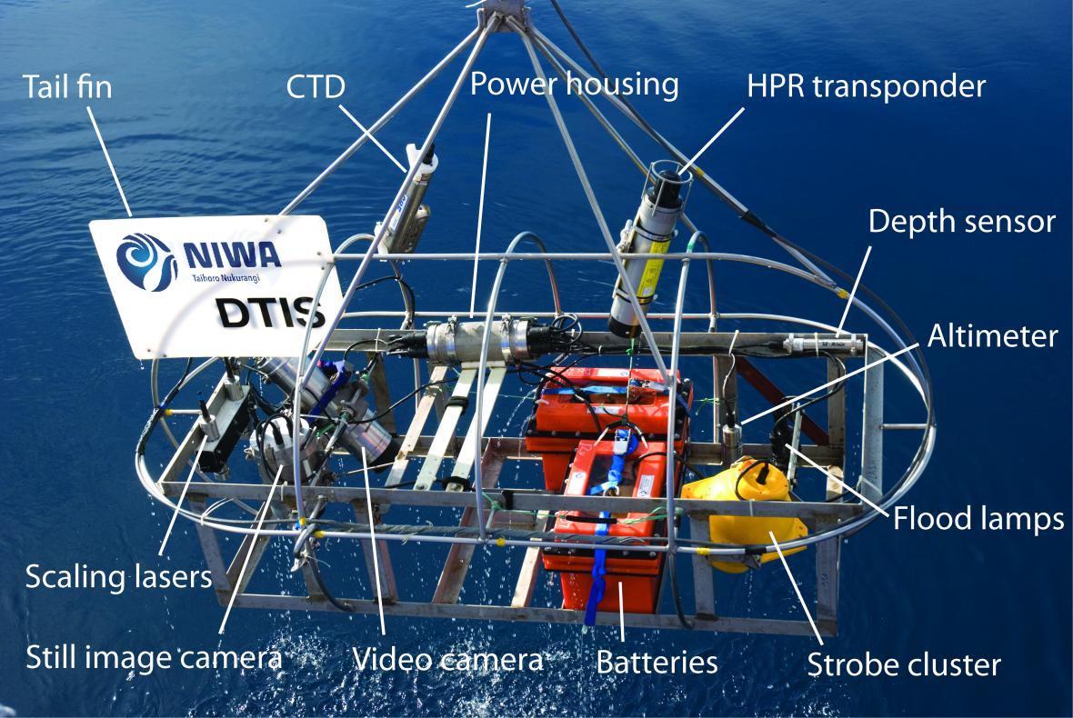
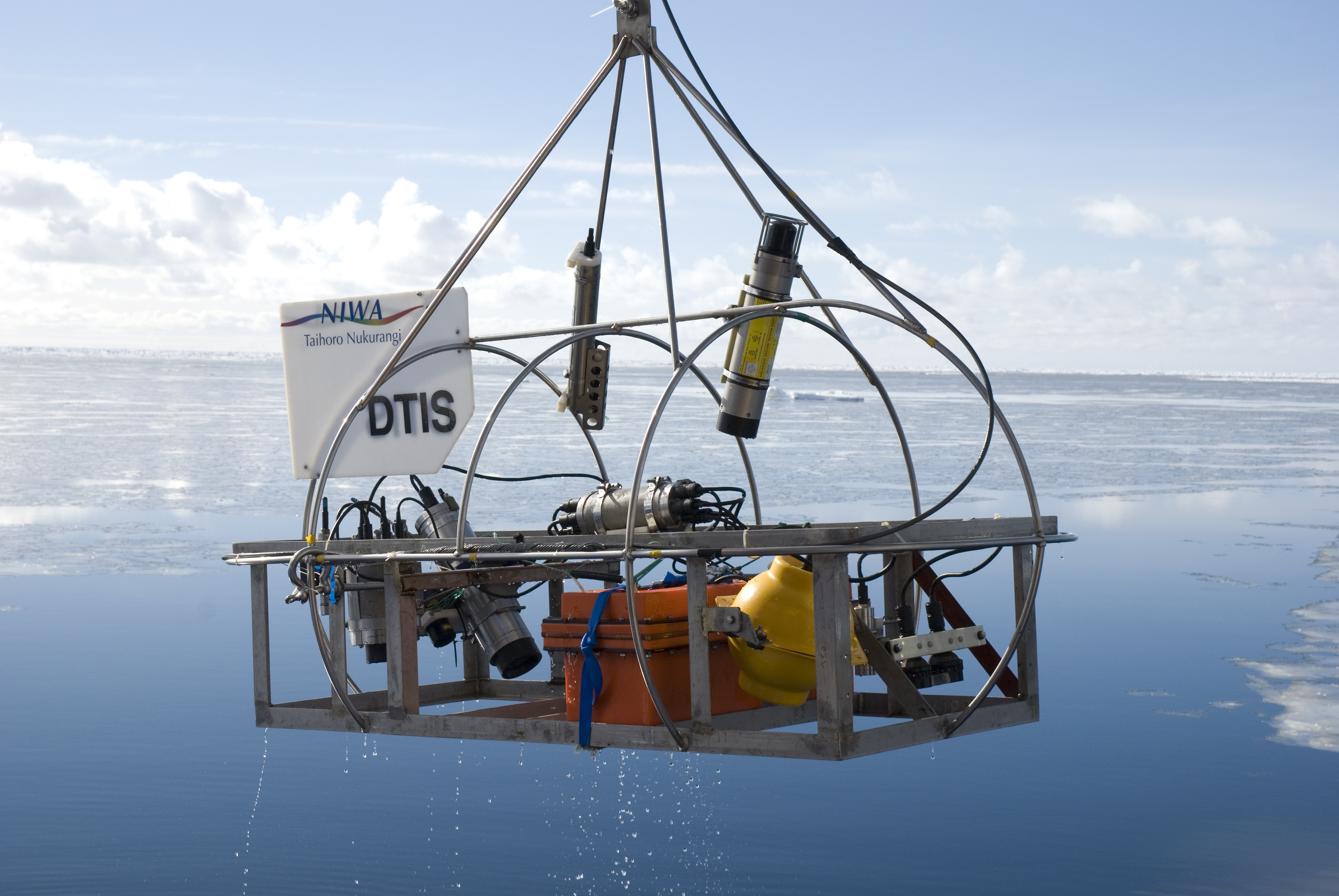
NIWA has been using its Deep Towed Imaging System (DTIS) since 2006. DTIS is a camera system designed and built by NIWA staff, which is used to take pictures and video of deep sea biodiversity and seafloor habitats.
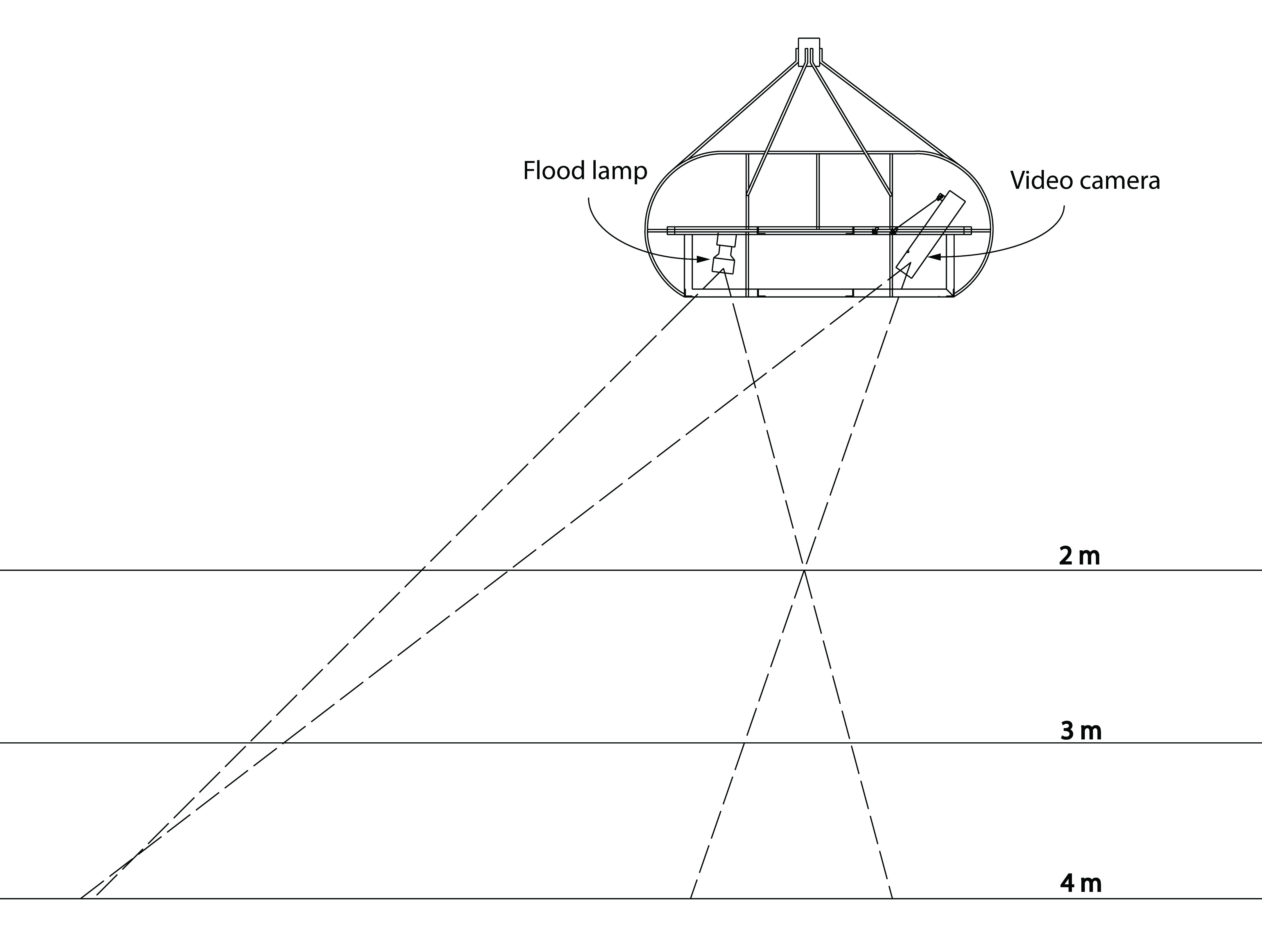
It has high definition still and video cameras, lights, strobes, laser pointers and batteries mounted in a rectangular frame. This frame is attached to the research vessel carrying it - often the R.V. Tangaroa - by a conducting wire.
Find out more about the RV Tangaroa
This wire allows the DTIS to communicate with the vessel, allowing researchers to see a live video feed, control its cameras and lights, and see information on depth and distance from the seabed.
The DTIS runs in transects - stripes - taking video continuously. The full length of each video transect is analysed and assessed for substrate (seabed) type, algae, benthic invertebrates (invertebrates which live on the seafloor), and fish.
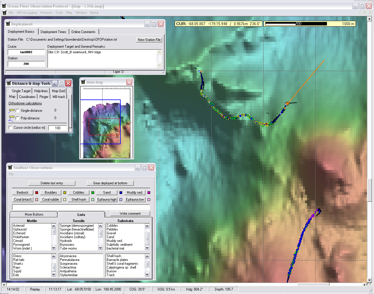
While the DTIS is submerged and recording, purpose-designed software called the Ocean Floor Observation Protocol (OFOP) is used to keep track of it, taking care of preliminary processing of the data and recording every occurrence of each organism - this is done very simply by the researcher on duty choosing from a list of taxon names.
Video can also be replayed in the laboratory when a deployment is over. Because all footage is recorded with accurate time stamps and seabed position coordinates, the video can be slowed down, reversed or sped up as needed to help with identifications.
Have a look at the scientific poster 'Seabed images: keeping track & making sense' for more information on how we use OFOP, DTIS and other photographic analysis software called NICAMS.
Seabed images: keeping track & making sense (PDF 8.9 MB)
Further information
Information about a selection of voyages in which DTIS has been involved can be found below.
Critter of the Week
NIWA's Invertebrate Collection has a public Facebook page - Critter of the Week - which introduces and has pictures of a different 'critter' each week. Many of the photos were taken with the DTIS!
Vulnerable Deep Sea Communities
In May 2012, NIWA's research vessel Tangaroa returned from a 3-week voyage, with pictures, film footage (see video below) and samples of new discoveries from the deep-sea floor, including footage of a new hydrothermal vent on an undersea volcano. More information on the voyage: TAN1206: Vulnerable Deep Sea Communities II - can be found in the media release linked to below.
See our TAN1206 photo gallery for some of the best specimen photos from the voyage
Vent and seamount fauna - Tangaroa Seamount from NIWA on Vimeo.
Diversity of seafloor life on Kermadec Seamounts
This amazing footage was captured at the Kermadec Ridge in 2011, by NIWA's Deep-Towed Imaging System (DTIS). The laser dots are 20 cm apart, and allow us to judge the size or scale of the organisms and features we photograph.
The voyage was part of a survey of valuable ore deposits and ecosystems along the volcanic Kermadec Ridge north of New Zealand, designed to inform both potential development and management of seabed resources in the area.
Biodiversity in the Kermadecs from NIWA on Vimeo.
CenSeam
CenSeam - the Census of Marine Life on Seamounts - involved a number of voyages between 2006 and 2010, and the DTIS was used on some of these. See the CenSeam website for details of the research, voyages and results.
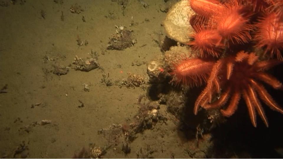
Macquarie Ridge - 'Brittle Star City'
In 2008, international attention was focused on 'Brittle Star City', discovered during the TAN0803 voyage. A dense population of brittle stars was discovered on a seamount in Antarctica - as a Water and Atmosphere article wrote at the time, "scientists saw the new metropolis, sitting atop a seamount taller than the world's highest building and crossed by the superhighway that is the Antarctic Circumpolar Current. They nicknamed it Brittlestar City."
Read our W&A article 'The submarine metropolis of Brittlestar City'
It was the first time colonies of brittle stars like this had been seen feeding on seamounts. The voyage also brought back numerous other find, many of which turned out to be new to science.