-
Online services
ServiceNIWA provides online access to major climate and environmental monitoring systems, databases and forecasting tools. -

Library
ServiceThe NIWA library collection contains items in a range of formats, covering subjects including atmospheric and climate research, aquaculture, oceanography, fisheries and marine sciences. -
Sea levels
ServiceThis system combines daily sea-level data from NIWA, regional councils, port companies, Antarctica NZ, Bureau of Meteorology and territorial authorities. -

Canterbury Wave Conditions
Software Tool/ResourceNIWA run a computer model which simulates wave heights across the Canterbury continental shelf and along the coast. -
Download Bathymetry Data
Software Tool/ResourceThis dataset provides the most up-to-date bathymetry of one of the largest areas of deep-water seabed under national jurisdiction. The 250m resolution gridded bathymetric data set encompasses New Zealand's Exclusive Economic Zone and is available in multiple high-resolution file formats to suit a range of imagery and mapping needs. -

Urban Infrastructure and the Built Environment Toolbox
ServiceThis helps planners, engineers, asset managers, and hazard analysts in urban councils understand and evaluate the potential impacts of climate change. -
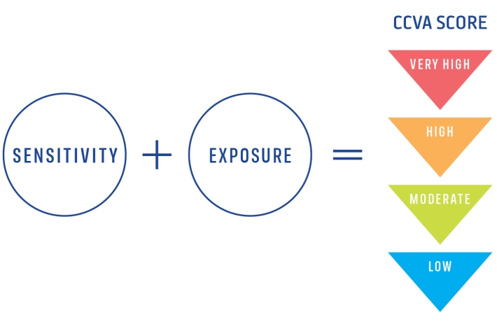
Climate Change Vulnerability Assessment (CCVA)
ServiceTo prepare for changes in climate, our freshwater and oceans decision-makers need information on species vulnerability to climate change. -
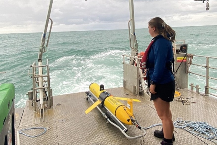
Ocean gliders
ServiceUsing a novel observational platform – ocean gliders—this research will observe and understand subsurface variations in temperature, salinity, oxygen and biological factors in water shallower than 200 metres – what we consider to be the shelf seas. -
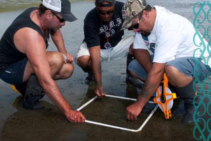
Ngā Waihotanga Iho - The Estuary Monitoring Toolkit
Software Tool/ResourceThe main purpose of Ngā Waihotanga Iho is to provide tools for the public to measure environmental changes that occur in estuaries over time. These changes may occur due to natural processes and/or human activities. -

Aquaculture Environmental assessments
ServiceGrowing global demand for protein and high-value food products from the sea is creating a significant economic opportunity for environmentally responsible and sustainable aquaculture.