Periphyton monitoring in lowland streams - how to get better and more frequent data
Periphyton (benthic algae) is an integral part of lowland streams and plays an important role in the river ecosystem. NIWA is investigating more effective methods of monitoring this important algae.
Periphyton is important but difficult to monitor
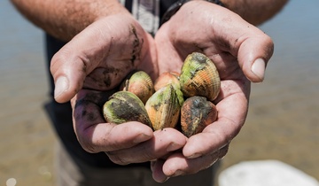
While periphyton helps purifying waters by absorption of metals and nutrients, and providing a significant component of the food resources in a stream, high levels of periphyton cover can have detrimental effects on stream biodiversity and aesthetics. Therefore, periphyton cover is routinely monitored in many streams.
Unfortunately, monitoring usually requires field visits for visual assessments as well as sample taking, which makes it labour intensive and costly. Also, sites are only assessed infrequently and little information exists about the periods between visits.
Improved use of multispectral cameras being investigated
NIWA is investigating the use of a multispectral camera to provide frequent and informative data on periphyton. To date, a scoping study with image data collected at possible monitoring sites has been conducted to develop data processing methods as well as extract spatial coverage of two periphyton types — green algae and diatoms.
To successfully automate the classification of the data collected, each feature of interest (i.e., background gravel as well as various types of periphyton) must be identifiable by its unique spectral response — its “spectral signature”. While the targeted stream bed cover types vary slightly in colour from grey to black and green to brown — differences that can be perceived with the naked eye, they have more pronounced differences in wavelengths of the near infrared which lie outside the visible spectrum of light.
The wavelengths in which the multispectral camera collects data were chosen to allow the distinction between background gravel and individual periphyton species commonly found in lowland streams, like cyanobacteria, diatoms and green algae.
Addressing limitations of existing multispectral imagery
Multispectral imagery is now routinely used to monitor harmful algal blooms in coastal waters and large lakes. The imagery is usually collected by satellite platforms and has a very coarse spatial resolution of dozens to thousands of metres. Our study is aimed at filling the gap in research using multispectral technology to monitor small streams at very high spatial (cm scale) and temporal (daily) resolutions.
Early results encouraging
Initial results are very promising (see figures) and the camera is now being installed at a monitoring site for an extended period of time to take images on a daily basis. The research will investigate a more efficient, quantifiable, and spatially more coherent method of monitoring time-series of periphyton cover.
Contact