Fisheries Oceanography II, Chatham Rise (TAN1116) - Voyage Log
NIWA's research vessel Tangaroa was at sea 2-20 November 2011 for the TAN1116 voyage.
During TAN1116, NIWA conducted a survey of fish-food in the western and mid-Chatham Rise. This is a very productive part of our ocean, an important area for the New Zealand commercial fishing industry. The voyage is part of an ongoing program that focuses on ecosystem-based management of ocean resources: we are trying to understand how the ecosystem affects fish, and how fisheries affect the marine ecosystem. For that, one needs to understand the local marine food web - i.e. who eats whom.
Previous work has established what fish eat, but in this voyage our scientists were going to look to see exactly where the fish food is, how much is around, and what the fish food (shrimp, salps, other small fish) are eating.
For more information on this research, see - Trophic modelling for sustainable New Zealand fisheries.
The links below are for updates and photos from the voyage.
This is the second voyage in a series investigating the Chatham Rise ecosystem. This survey is funded by the Ministry of Science and Innovation.
Day 15
Day 14
Day 13
Gallery - Noctiluca scintillans (phosphorescent algae) bloom
Day 12
Days 10-11
Day 9
Day 8
Day 7
Day 6
Day 5
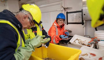
The multicorer is used to take samples of the surface sediments of the ocean, which contain many of the minute organisms making up up the highest biomass on the planet.
Day 4
A beam trawl brought up a hagfish!
Day 3
Day 2
Midwater trawl nets - very large, fragile nets - are used to catch 'clouds' or groups of fish or invertebrates that appear at a particular depth under the ship
Day 1