Descriptions of the common terms that explain the processes that occur in hydrology.
Hydrological cycle
The movement and storage of water in our natural environment is described as the hydrological cycle. Water is found in liquid (rain, river flow), solid (snow, ice) and gas (water vapor, evaporation) forms.
The key storages and processes within the hydrological cycle are:
- evaporation from the Earth's surface (from oceans, land and vegetation)
- precipitation (in the form of rainfall, snow, hail, mist and fog)
- soil moisture
- groundwater
- streamflow.
Key drivers of the hydrological cycle include radiation from the Sun, the seasons, winds, weather patterns, and precipitation.
Precipitation
Precipitation is moisture that falls onto the land surface as rain, dew, snow or hail. Rain is drops of water that have coalesced from clouds and fallen to the ground. Rain is measured with raingauges set at standard heights above the ground surface. Recording raingauges record rates of rainfall: manual raingauges are read by observers, typically daily at 9am. Typical measurement units are millimetres per day and millimetres per year. Dew is the result of condensation of water vapour onto surfaces that have cooled by radiation during night-time. Dew is normally a minor component of the hydrological cycle and is rarely measured. Snow is atmospheric vapour frozen into ice crystals and falling to earth in light white flakes. Snowfall, and the equivalent moisture content, is difficult to measure reliably. Hail is pellets of frozen rain. Hail also is difficult to measure reliably.
Evaporation
Evaporation is the transfer of water from liquid to vapour. Evaporation occurs from water bodies (oceans lakes, river, ponds), from the ground surface, and from vegetation. Evaporation is the source of moisture that falls as precipitation.
Soil moisture
Soil moisture is water held in soil layers above the level at which groundwater (see below) occurs. Soil moisture is replenished by rain and by capillary rise from groundwater, and depleted by evaporation from the soil surface and by plants transpiring water extracted from the soil by their roots. A soil mass that is fully wetted, but freely drained, is said to be at field capacity. When soil moisture is reduced to a level at which plants can no longer transpire freely, the soil moisture level is said to be at wilting point.
Groundwater
Groundwater is water found in the ground, particularly that which occurs below a free surface in a well. Groundwater levels are often monitored with water level recorders.
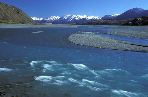
Streamflow
Streamflow is flowing water in a stream or a river. Rate of streamflow, or discharge is measured at streamgauges. The measurement units rate of streamflow are volumes per unit time: e.g. cubic metres per second, or cubic kilometres per year. River water levels and streamflows are measured in New Zealand by staff from NIWA and regional and district councils. Also measured are water quality parameters, including sediment and pollutant concentrations. Streamflow varies in time at any river location according to precipitation inputs upstream of the location. Short-term variations are caused by recent rainfall events, or by human controls upstream (such as hydropower operations or irrigation abstractions). Seasonal variations are related to either an absence or predominance of rainfall events. Longer-term variations are related to climate shifts or trends, and to land-use changes (such as afforestation of the catchment upstream of a river location). Past records at a river location are used to estimate expected monthly and seasonal mean streamflows and their expected variations. The actual mean streamflow for a month can be expressed as a percentage of the long-term mean for that month using the past records.
Runoff
Runoff is streamflow rate, presented as the average depth of water flowing off from the catchment area of the river basin. Typically runoff from a river basin is presented in units of millimetres per day or millimetres per year, enabling comparison with average rainfall over the river basin.
Hydrograph
A hydrograph is a graph where streamflow is plotted against time. By choosing suitable scales for time, the short and long term variations of streamflow can be displayed. Short-term patterns include flood hydrographs in response to storms; long-term patterns include seasonal variations, and responses to long-term variations in rainfall.
Rainfall-runoff model
A rainfall-runoff model is a mathematical representation of the movement of water through a river basin. These models are used to link rainfall, soil moisture, evaporation, groudwater and streamflow.
Flood forecast
A flood forecast is a prediction that flooding is imminent. Commonly flood forecasts are issued when heavy rain falls, or is expected to fall, over a river basin.
Flood frequency
Flood frequency is the relationship between flood size and the probability that a flood of that size will be exceeded.
Low flows
Low flows are the streamflows that occur during a prolonged absence of rain. Probabilities of low flows can be assessed in a manner similar to the way that flood frequencies are expressed.