Stitching together a new view of the seafloor
Combining multibeam bathymetry, specialist GIS software and high-resolution camera footage, NIWA has produced startlingly vivid three-dimensional photo-mosaics of undersea habitats.
Marine ecologist Tara Anderson and her colleagues recently undertook a video survey of parts of Queen Charlotte Sound, Tory Channel and nearby Cook Strait to find out whether direct observations of the seafloor could be used alongside multibeam bathymetry to predict the presence of seafloor habitats and biological communities.
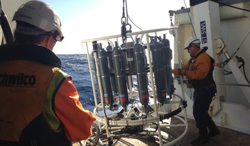
They collected over 30 linear kilometres of footage, including images from a towed underwater camera system that was co-designed and built by Anderson.

Data programming, Structure in Motion and GIS software were then used to align and stitch together sequences of camera images from the video footage, creating beautiful photographic mosaics that show the shape, height and complexity of the seafloor and what's living there.
“It’s comparable to what smartphones do when making a panoramic image, but unlike the simple 2D image your smartphone can make, these photo mosaics are created in 3D,” Anderson says.
“They can be clicked and rotated to show species distribution and the complexity of physical structures such as reefs or cobble fields, and biologically-formed structures such as tubeworm towers and bryozoan reefs.”
Anderson says the technique provides an exciting new tool for marine scientists working with management agencies such as Regional Councils.
“Fine scale seafloor features that are important to marine organisms are now able to be examined, quantified and spatially integrated with detailed bathymetric data such as that collected on a previous multibeam survey of Marlborough Sounds.”
“It’s already been put to good use helping researchers quantify and predict significant habitats and communities within Marlborough Sounds. There, Marlborough District Council staff have been able to see the spatial structure of undersea habitats that they're currently managing or wanting to protect,” says Anderson.
“We’ve revealed several areas that support significant habitats that were not previously known, including several sites with fragile tubeworm towers – known to be created over numerous decades by a species called Galeolaria hystrix. Groups of anemones, hydroids, kina and starfish have also been revealed within the ‘living’ (biogenic) habitats.”
She says mosaic mapping integrated with multibeam mapping will be the way of the future to map both the physical and biological features that make up habitats for marine life in New Zealand. It's only recently been applied to mapping marine seafloors in the Northern Hemisphere and NIWA is leading the charge in its use in the Southern Hemisphere.