Factors influencing abundance and distribution of humpback whales
The ice-covered Balleny Islands is a 160km island chain in the northern Ross Sea and a known foraging area for humpback whales. This voyage will undertake a range of surveys around the islands to understand the factors influencing abundance and distribution of the whales - including what they eat.
Humpback whales are known to arrive on their Antarctic feeding grounds at the start of November and depart in April. The proposed survey will take three days and follow a zig-zag path of approximately 320 nautical miles around the Balleny Islands from close to shore to about 1000m depth.
Sampling methods
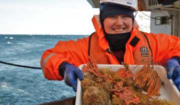
Sampling methods will include water sampling, fisheries acoustics, and mammal and seabird sighting. Where possible, biopsies will be taken from whales. Water sampling will include trawling the mesopelagic layer to provide samples for trophic studies. The mesopelagic layer is commonly known as the 'twilight zone' of the ocean and includes depths from about 200 - 1000m.
Related information

A humpback whale flukes up near RV Tangaroa in the Southern Ocean during the Antarctic Whale Expedition 2010. [Credit Rochelle Constantine]

This proposed survey design around the Balleny Islands shows survey transects with red lines. The 1000m isobath is also shown.