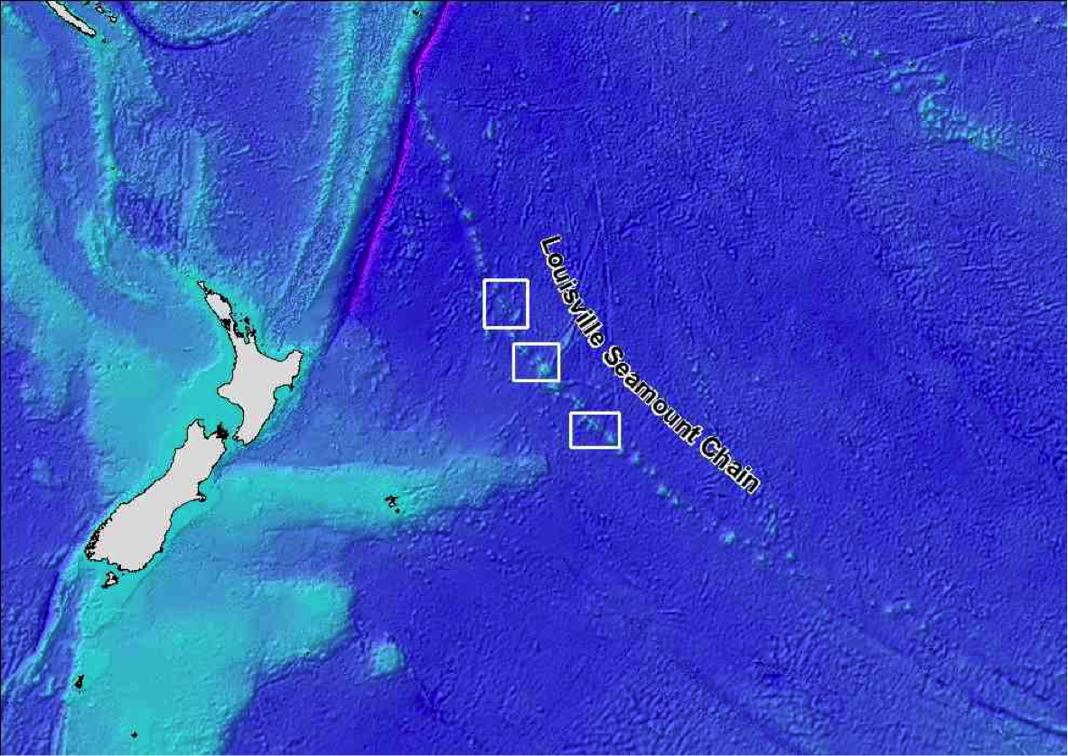
We are currently steaming out towards our survey area, the Louisville Seamount Chain, which is about 1500 km from Wellington.
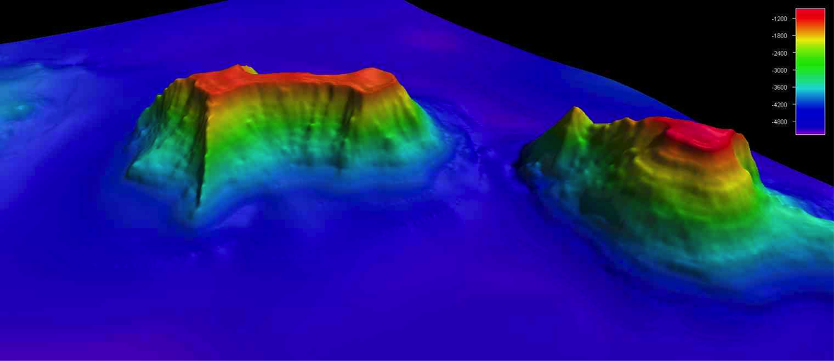
Seamounts are undersea mountains, like Mt Ruapehu or Taranaki, but rising from the seafloor rather than on land. The chain comprises over 80 large seamounts, extending in a 4000 km arc from way out in the South Pacific Ocean northwest towards Tonga. The seamounts start life as active volcanoes, formed over a "hotspot" in the earth's mantle (the viscous layer between the earth's core and the crust) - in the same way as the Hawaiian Islands have formed.
Movement of the large tectonic plates that form the earth's crust means that the volcanoes shift away from the hotspot after a few million years, and are then slowly transported northwestwards. New volcanoes are formed over the hotspot, and the process repeats itself, ultimately forming a chain of seamounts.
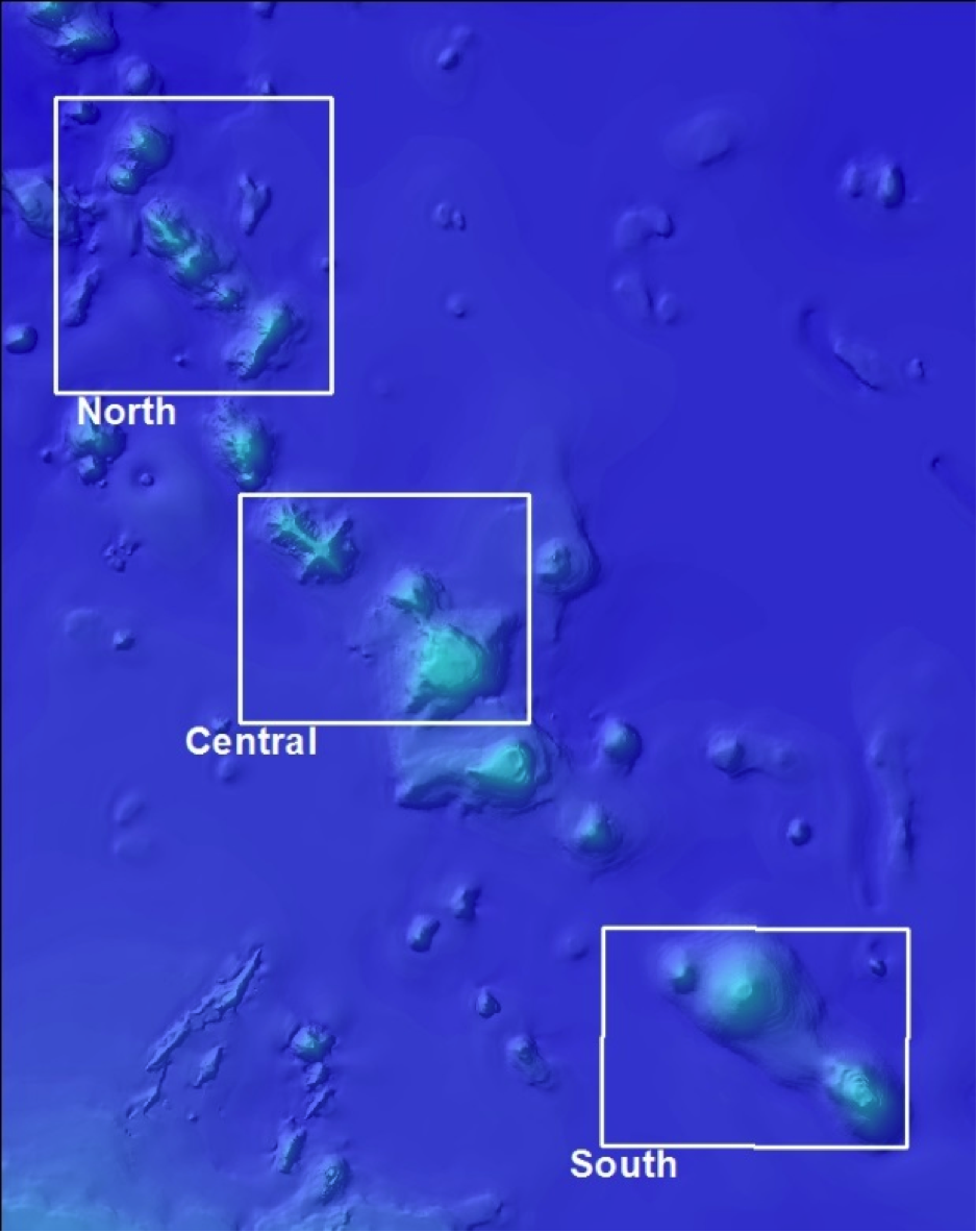
The seamounts were discovered by various US Navy ships, sailing to and from Antarctica during the early years of Antarctic exploration in the late 1950s and early 1960s. One of the first to be sampled, in 1961, was Valerie Seamount, named after the wife of one of scientific expedition leaders that year. It is the southern-most of the 6 seamounts that we plan to survey during this voyage.
The seamount chain has been fished for orange roughy since the 1990s, and is one of the main fishing areas for the species outside the New Zealand EEZ. The bottom trawling techniques used to catch orange roughy are of concern for potentially damaging VMEs, and this is especially the case on seamounts where species like deep-sea corals can form extensive reef-like structures. Hence the range of seamounts on the Louisville Chain, with different environmental characteristics and fishing levels in the past, offer a good area to test whether the habitat suitability model predictions are true, and if they can then be used to help management of the fishery by SPRFMO.
Malcolm Clark NIWA