High-tide red alert calendar with mean sea levels
The high-water red-alert calendar forecasts days when the tide + mean sea-level anomaly will be unusually high.
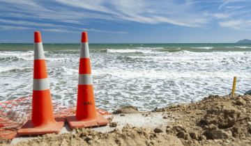
If these very high waters combine with large waves or storm surges there is an increased chance of flooding or coastal erosion. The predicted high-waters include the height of (i) tide + (ii) mean sea level (MSL), and (iii) mean sea-level anomaly (MSLA). N.B. Storm surge is not included in the forecasts.
Tides are driven by the Sun and Moon’s gravity and can be predicted many years in advance. The MSL is the long-term sea-level average. MSLA results from climate variability such as seasonal heating and cooling and the El Niño Southern Oscillation (ENSO) – MSLA is predicted 6 months in advance.
These calendars are updated monthly and the first six months include MSLA forecasts built using a statistical model incorporating forecasts from a dynamical coupled ocean-atmosphere model (see the NCEP CFSv2 and the state of the El Niño Southern Oscillation) at the time the forecast was made.
For each location, there are two types of calendar provided: (i) a calendar showing the alert days for the next 12 months, and (ii) a calendar for each month (e.g. Jan, Feb, …) with details of high and low tides for each day and a plot of forecast sea-level with time. The red shading (“red-alert”) shows the highest 1% of all high-waters, the orange shading shows the highest 5%, and yellow shading the highest 10%.
High-water alerts are provided for: Marsden Point, Auckland, Moturiki, Wellington, Lyttelton, Dunedin relative to their local vertical datums as downloadable PDF files. These files are updated every month. Other sites will be made available in future.
This work was funded by the Natural Hazards Research Platform 2015 funding round.
| Calendar location | Size |
|---|---|
| 2.7 MB | |
| 2.7 MB | |
| 2.7 MB | |
| 2.7 MB | |
| 2.7 MB | |
| 2.7 MB |