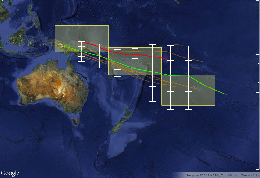
The ensemble of global climate models for rainfall that are used in METPI show an area of higher than normal rainfall associated with the SPCZ position.
The green line indicates the average SPCZ position for the forecast period based on the average of 8 climate models. The white vertical bars and 'whiskers' indicate the one and two standard deviations between the model projections of the SPCZ position every 5 degrees of longitude.
For the coming three months, the models indicate that the SPCZ is likely to sit in a position near or slightly south of climatology (orientation of the SPCZ very similar to climatology, with mean positional displacement southward).
Uncertainty is however greatest over the Eastern part of the domain over and east of the Dateline.